Route 66, or the Mother Road, is indelibly stitched into the fabric of the American psyche. The iconic road once traced its way for 2,448 miles from Chicago, Illinois, to Santa Monica, California. But it was more than just a long stretch of tarmac. Route 66 became a cultural phenomenon that inspired and piqued the American obsession with travel and adventure. Songs were written about it, quirky and kitschy roadside attractions sprouted beside it, and Americans longed to traverse it. The Mother Road was a main artery crossing the torso of the U.S. through which dreams and possibilities pulsed warm and red.
Related: Get Your Kickstart on Route 66 –
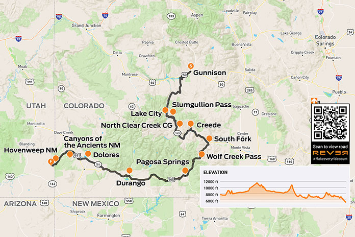
Riding a kickstart-only 1978 Yamaha SR500 from Chicago to Amarillo on the Mother Road
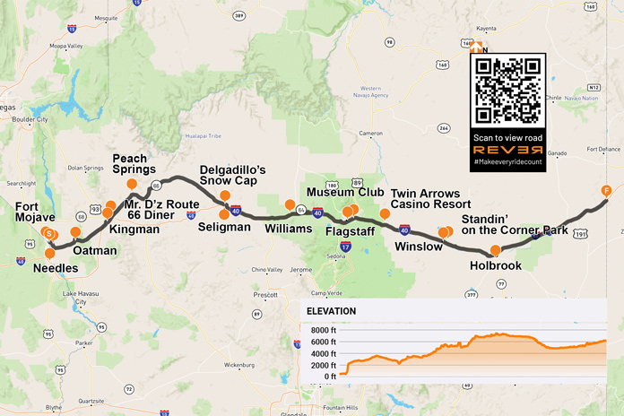
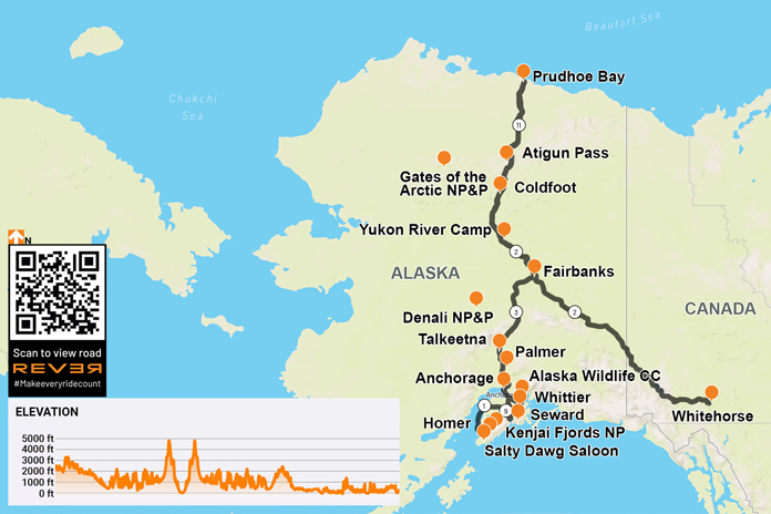
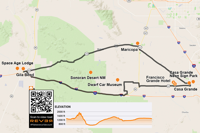
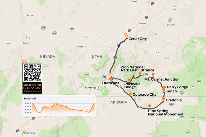
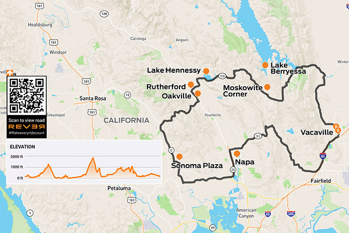
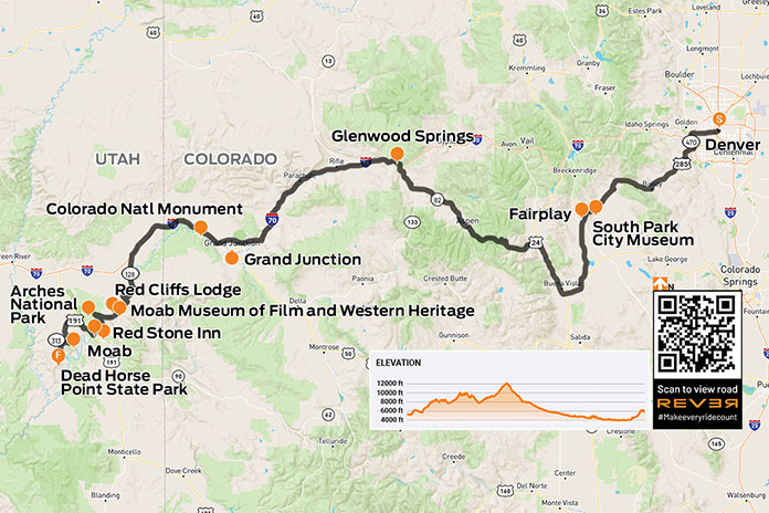
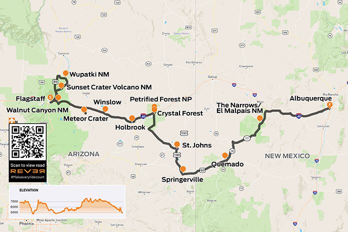
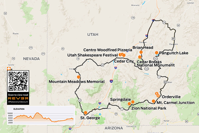
Scan QR code above or click here to view the route on REVER
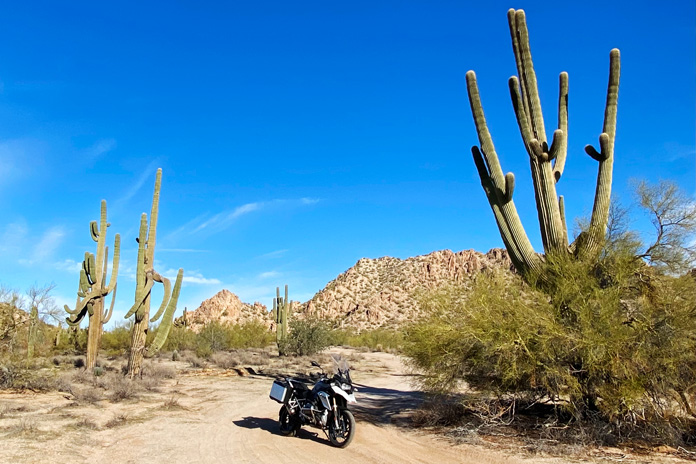
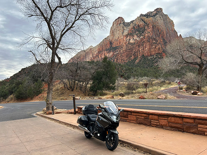
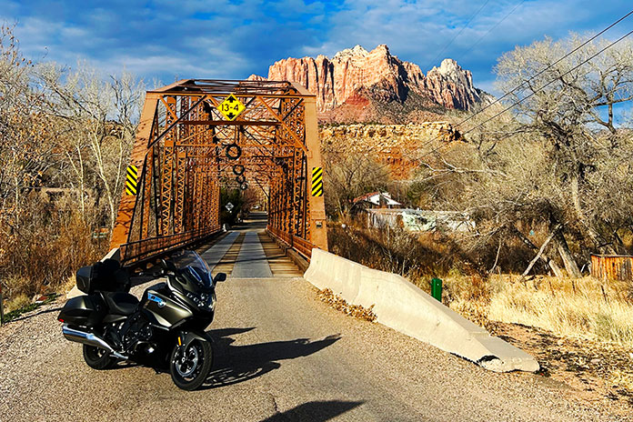
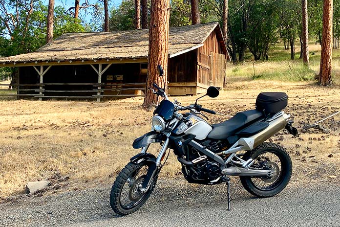
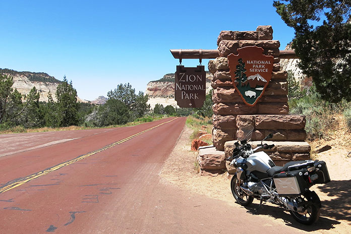
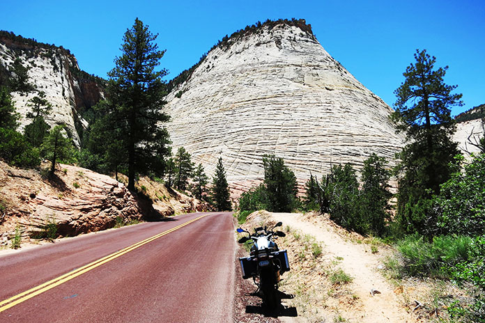
Yearning to rediscover the road, the towns, and the magic of Route 66’s path through Arizona, I packed up my BMW R 1200 GS and set out. Fittingly, my trek began Nov. 11, the date on which the Mother Road was designated a federal highway in 1926. Arizona claims the longest rideable portion of the original Route 66, and it has a significant number of attractions and bustling historic towns.
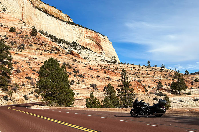
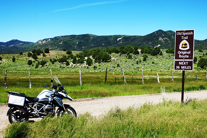
Riding from west to east, I began my Mother Road adventure on the Fort Mojave Indian Reservation where the Colorado River separates Arizona from Nevada. After a short climb toward the mountains on Boundary Cone Road, I came to an intersection indicating that I was transitioning onto the historic U.S. Route 66. The road became curvier and more interesting, and the jagged rock formations of Arizona’s Black Mountains became more immediate as the road coiled through the rugged terrain.
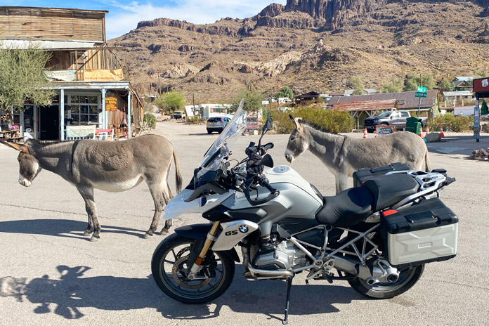
Within minutes, I entered the historic mining town of Oatman. In 1915, two miners struck a $10 million gold find. Within a year, the small mining camp grew to a population of 3,500. Recent census figures indicate there are now just over 100 human residents. If you include the dozens of semi-wild burros in the area, that population is much larger.
Oatman is a hotbed of activity during any motorcycle rally on the Colorado River or in Kingman. However, my BMW was one of only two motorcycles in town on this crisp November morning. I walked the street beneath the weathered wood facades of the various shops and watering holes.
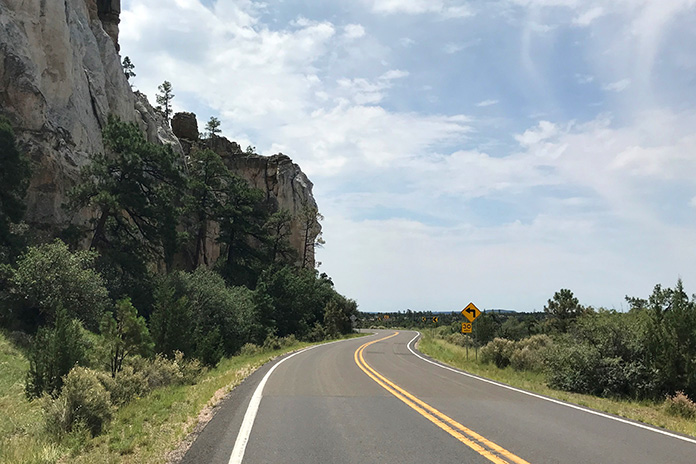
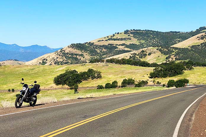
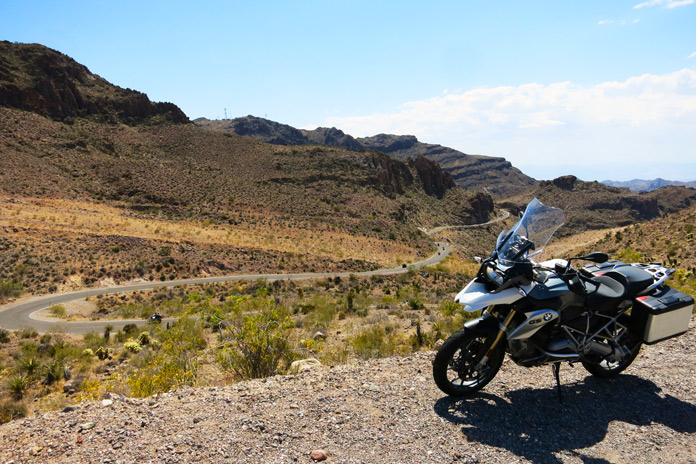
Route 66 north and west of Oatman is a pure delight. The pavement is mostly smooth and intact, and it’s filled with sweeping turns and hairpins, many of which are nicely banked. There are several signs warning motorcyclists to stay aware, and these are best heeded. With the road gradually uncoiling, I made my way toward Kingman, passing several abandoned open-pit mines that dotted the rocky slopes and at least one small operating mine.
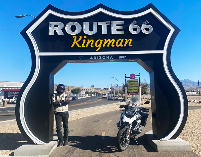
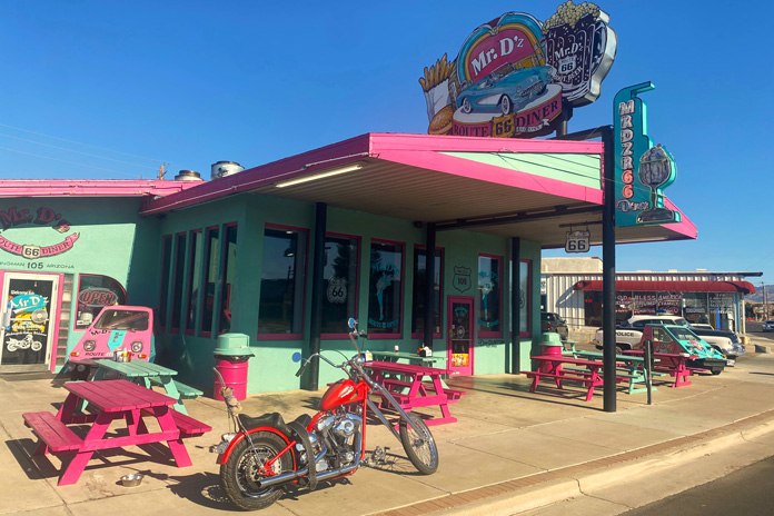
I was ready for a cup of coffee and some gas when I rolled into Kingman, where my father was an art teacher in the local school district before I was born. It is a clean and bustling small city fully embracing its Route 66 roots. I stopped at the colorfully adorned Mr. D’z Route 66 Diner and parked amidst historic cars, trucks, and motorcycles. As I chatted with my server over a hot cup of joe, she talked about the dual nature of the city. We were in the historic downtown district, but just a little ride up Interstate 40 is the modern district with chain hotels, restaurants, and thriving industry.
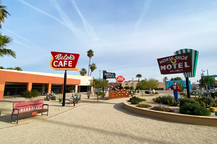
After rolling through the industrial zone in the Kingman outskirts, I headed northeast on the longest existing stretch of the Mother Road. Small roadside businesses dotted the path toward Peach Springs, each clearly embracing its Route 66 heritage with appropriate signage and vintage memorabilia. Historic gas stations were particularly interesting. While they no longer pumped fuel, they still oozed with the nostalgia of the road’s heyday.
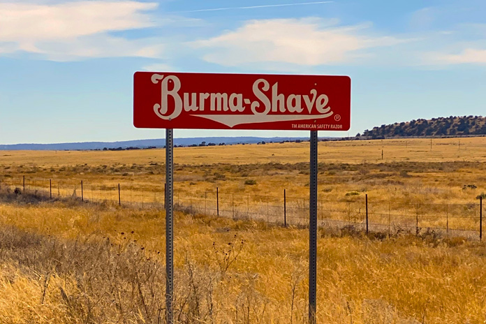
After Peach Springs, I rode past three sets of Burma Shave signs with rhyming slogans, reminding me of childhood. As I rolled and swayed through the high grasslands, it was easy to imagine classic cars and motorcycles plying this portion of the route.
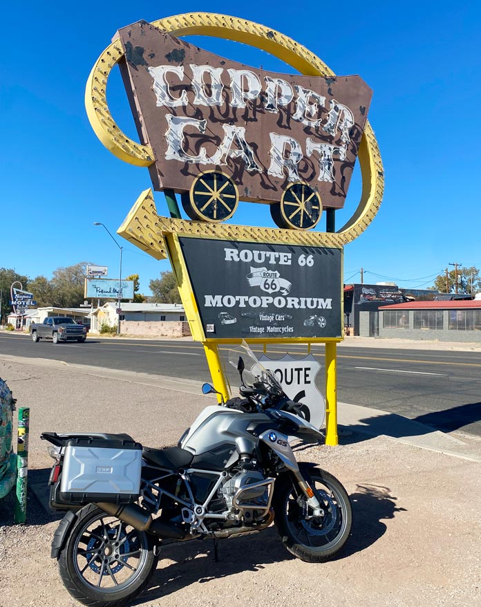
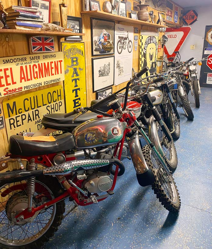
Entering Seligman was the most visually nostalgic part of my ride. This small town is a well-preserved tribute to its Route 66 heritage, with every shop, garage, and diner adorned with colorful signage and logos. Out of the corner of my eye, I saw a small sign for the Route 66 Motoporium. Not expecting much, I threw down my kickstand and walked into the Copper Cart to see what was inside. A bearded man said, “You look like a rider,” and pointed to a room in the back. It was filled with the motorcycles of my youth – both those that I rode and those that I ogled in the pages of motorcycle magazines of the 1960s and ’70s. Vintage Indians, Hondas, Hodakas, and Kawasakis, especially the 2-strokes, brought me back to the enchanting smell of premix laced with single-track dust that was a big part of my teenage life.
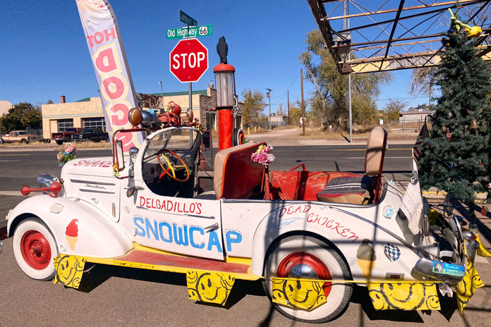
After a lengthy trip down moto-memory lane, it was time for lunch, and the legendary Delgadillo’s Snow Cap diner was just a block away. Juan Delgadillo and his wife, Mary, opened the Snow Cap in 1953, and Juan and his brother Angel formed the Historic Route 66 Association of Arizona. The Delgadillo family still owns and runs the historic diner, and I had a fantastic green chili burger and onion rings.
East of Seligman is a short stretch of the original Route 66 that runs into I-40 just before Ash Fork, and I noticed a few remnants of the Mother Road that are now spurs off the roadway. Beyond Ash Fork, much of Route 66 has been fully replaced with I-40, but there are still several towns that have embraced and preserved their historic Mother Road character.
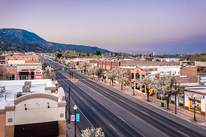
Williams, just off I-40, was the last town to be bypassed by the interstate, and it still teems with Route 66 charm. The main street is lined with historic stone buildings filled with antique stores, diners, and bars. I motored by one of the more famous watering holes, the Sultana Bar, which was opened in 1912, predating Route 66 by more than a decade.
See all of Rider‘s Arizona motorcycle rides here.
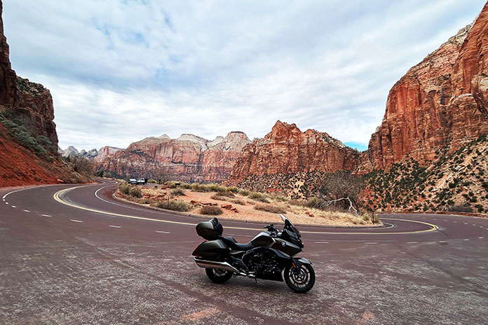
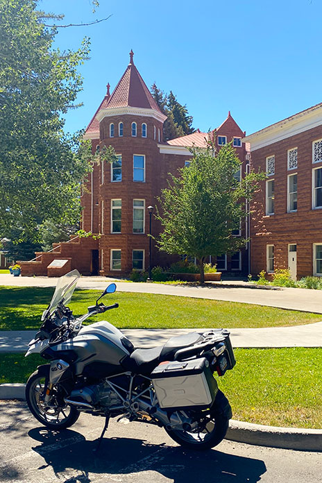
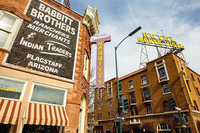
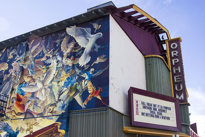
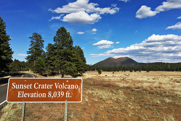
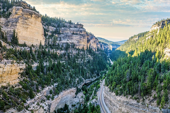
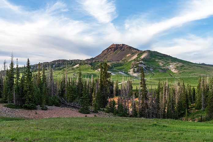
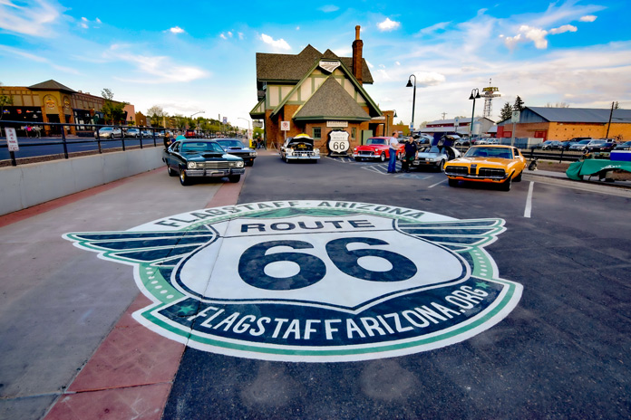
After Williams, I-40 is as attractive as an interstate can be. Views of the San Francisco Peaks tower impressively to the north, and vibrant evergreens line the road. Flagstaff is the largest city on the Arizona portion of Route 66 and is home to my alma mater, Northern Arizona University. The original Route 66 skirted the beautiful campus just to the west and north.
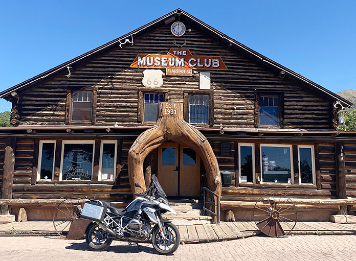
Flagstaff boasts several original Mother Road attractions, including the historic downtown train station that houses the Flagstaff Visitor Center. On the way out of the city, I rolled past several diners that boast the Route 66 name, but my favorite is Miz Zip’s Route 66 Cafe. Then I felt the magnetic pull toward the Museum Club, an iconic Route 66 watering hole and one of my favorite college hangouts.
See all of Rider‘s Western U.S. motorcycle rides here.
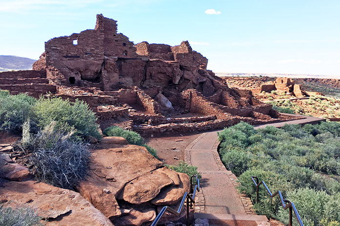
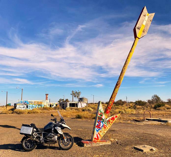
The majority of Route 66 east of Flagstaff has been replaced by I-40. While that is a shame, there is solace in the fact that many of the original attractions of the Mother Road era are still partially or fully intact on the way to the Arizona/New Mexico border. I took the short access road to the ruins of the Twin Arrows Trading Post. Up until very recently, both twin arrows still stood, but the ravages of weather and time toppled one. The trading post was a fixture on Route 66 since its opening in the late 1940s. Just across the freeway looms the new Twin Arrows Navajo Casino Resort.
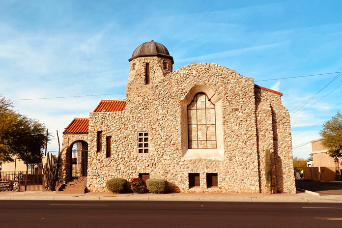
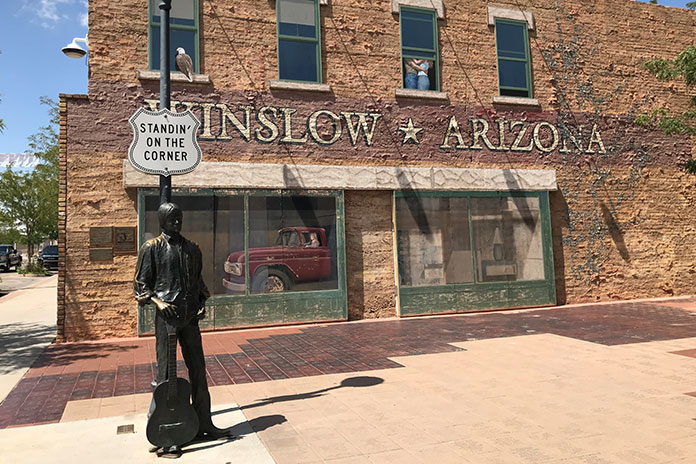
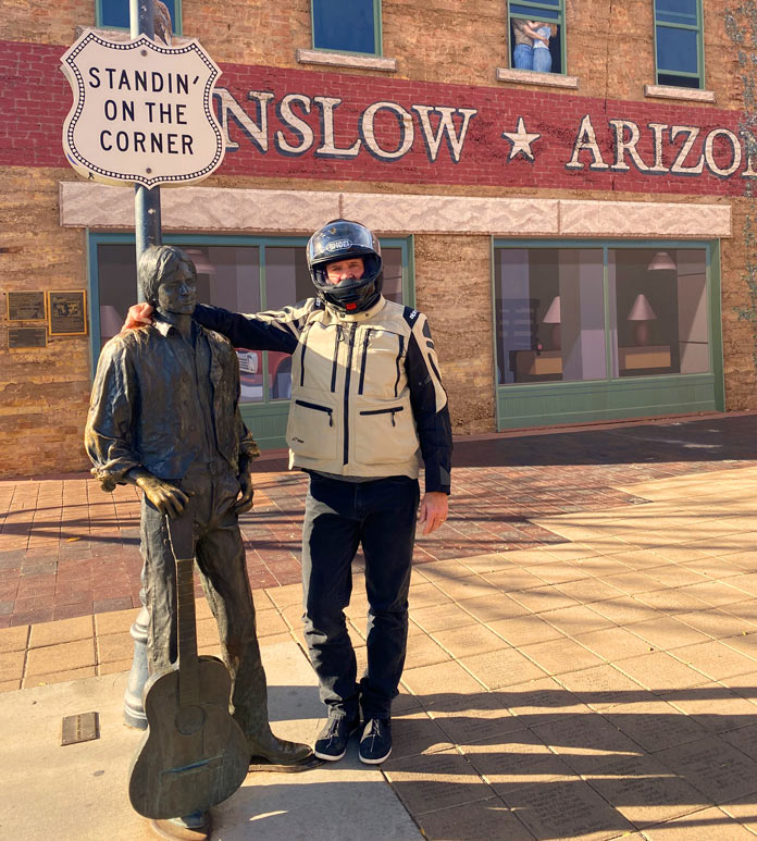
Riding another 30 minutes east on the interstate, I exited at Winslow, which sits on another existing stretch of Route 66. The loop into Winslow is festooned with various Route 66 advertisements. My first stop in town was to look at the impressive red sandstone St. Joseph’s Catholic Church. After snapping a photo at Standin’ on the Corner Park, I saddled up and headed to my lodging for the night, the beautifully restored La Pasada Hotel (see sidebar below).
After settling into my room, I walked the grounds of the beautiful rail-side resort before sitting with a post-ride cocktail and watching the trains roll by. Later that night, I strolled back into downtown Winslow for some shopping and a chili relleno dinner at the tiny Brown Mug Cafe. An unassuming photo on the wall beside my booth showed a youthful Harrison Ford sitting in the same spot many decades back (he’s an avid motorcyclist, by the way, and also owns a GS!).
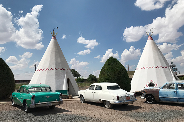
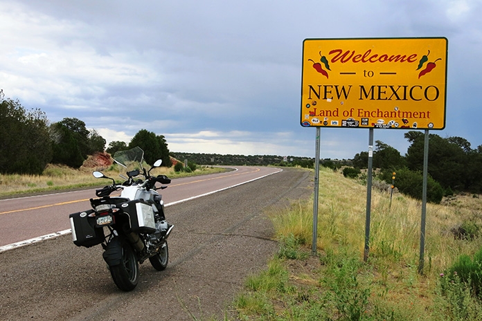
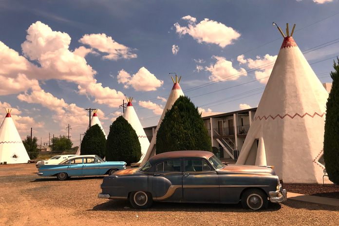
After a great night’s sleep, I had one last stretch to complete my Arizona Route 66 tour. I rode the few miles to Holbrook, which is the last of the original historic towns on my eastward stretch of Route 66 and home to the Wigwam Motel. From Holbrook, it’s another 74 miles on I-40 to the New Mexico border.
I highly recommend riding what you can of any portion of the Mother Road. This Arizona stretch of Route 66 is best ridden from late spring to early fall, as the winters in northern Arizona are cold and snowy. Pack for variable conditions, and enjoy your ride down memory lane.
Arizona Route 66 Motorcycle Ride Resources
SIDEBAR: La Posada Hotel
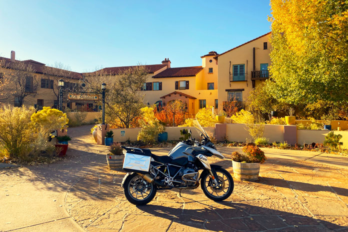
La Posada in Winslow is a crown jewel of the historic Fred Harvey railroad hotel empire. Designed in the 1920s by renowned architect Mary Elizabeth Jane Colter, it’s currently a first-class hotel, art gallery, and museum in an expansive garden setting. There is a gourmet restaurant on-site, and downtown Winslow is a short stroll away. The rooms are comfortable and well-appointed in a warm Southwestern motif, and photos of the hundreds of legendary actors and public figures who stayed at La Posada line the hallways. There is even safe designated motorcycle parking in front of the property. For more info, visit the La Posada website.
See all of Rider‘s motorcycle tours here.
The post Arizona Route 66 Motorcycle Ride appeared first on Rider Magazine.
Source: RiderMagazine.com