Tag Archives: U.S. Tours

Northern Utah Loops

Northern Utah motorcycle ride
Northern Utah is an enticing mix of high country views, rugged mountains, intriguing history and fantastic roads. Photos by the author.

I unfold a Utah map on my outdoor table at the Main Street Deli in Park City’s bustling downtown. After placing my gyro sandwich plate over the state’s southern half, I study the upper portion of the map. With my yellow highlighter, I carefully trace out my two enticingly twisty, yet distinctly different loop rides. One emanates southeast of Park City and the other extends to the northeast.

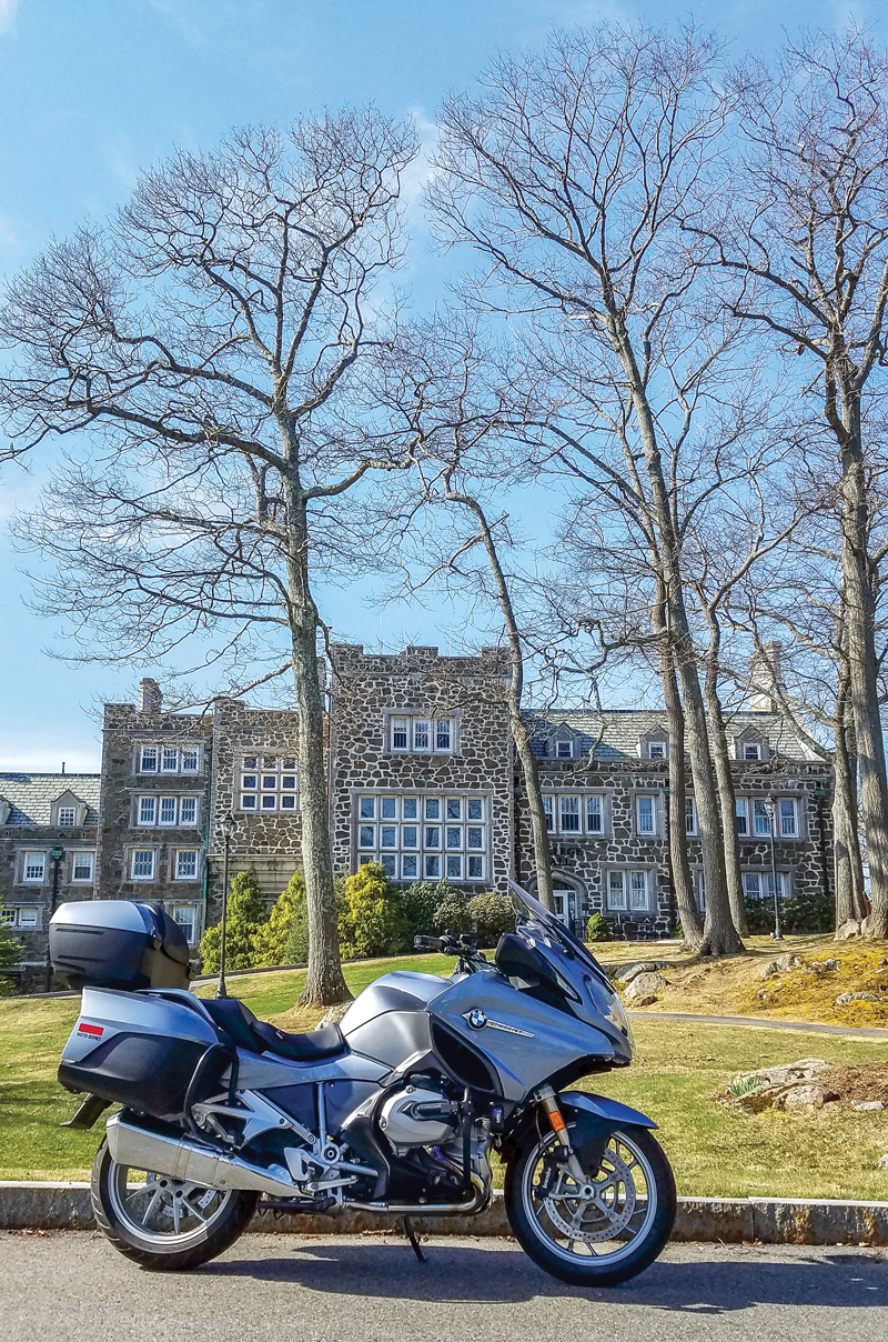
This picturesque hamlet will be my home base for an exploration of Utah’s high country. Nestled in the mountains due east of Salt Lake City, Park City was the site of much of the competitive activity of the 2002 Winter Olympics. The town rests at the base of the ski run-lined mountains that are its winter lifeblood.

Northern Utah motorcycle ride
Downtown Park City is full of restaurants and shops housed in historic brick buildings.
Northern Utah motorcycle ride

Park City buzzes with activity in all seasons. In winter, ski boots and fur-lined parkas are the attire de rigueur. However, mid-summer is the perfect time to pull on the riding boots and armored jacket and hit the road. The upscale village offers (slightly) discounted lodging for summer activities, like my planned double-loop foray into some of the most varied and striking motorcycle riding the Southwest has to offer.

After wiping the Greek tzatziki sauce from my whiskers, I am ready to throw a leg over my BMW R 1200 GS for an afternoon ride.

Northern Utah motorcycle ride
The historic Miners Hospital in Park City is now a community center hosting a variety of meetings and activities.

The Southern Loop – Wide Open Spaces

Following a short ride east through the historic buildings, ski chalets and bustling activities of Park City, I start my ride on U.S. Route 40. The long, sweeping corners are lined with grasslands and a wide variety of summer wildflowers. In no time, I am riding with the blue waters of the Jordanelle Reservoir to my left. The substantial body of water is virtually treeless, offering up miles of views.

Just a few miles after the reservoir, I roll through clean and tidy Heber City. Like most of the Mormon-founded towns in Utah, Heber City features a mix of modern homes and buildings as well as historic pioneer-era structures.

Northern Utah motorcycle ride
Map of the route taken, by Bill Tipton/compartmaps.com.

After Heber City, the human element fades, and the grasslands and low trees again define the landscape. Traffic is refreshingly light, and the undulating pavement is smooth and fun. The farther southeast I ride on U.S. 40, the curvier the tarmac becomes. This is a relaxing ride that requires little on the technical riding front, but offers much in terms of long-perspective visuals.

Strawberry Reservoir is the next notable water feature on the ride and it is substantially more expansive then the Jordanelle. I make the turn into the Strawberry Reservoir recreation area, and stop by the U.S. Forest Service depot that rests at the entrance to the area. The tidy Forest Service facility is a treasure-trove of information on the Dominguez–Escalante Expedition of 1776. The Spanish expedition was conducted to find and map a route from Santa Fe, New Mexico, to the Spanish missions in California.

Northern Utah motorcycle ride
The 1776 Dominguez–Escalante Expedition sites highlight the ride.

The paved roads that flank the reservoir are too much to resist, and I spend a fair amount of time exploring the lake’s shoreline. Having heard of the great views and interesting endgame offered after a ride south of Strawberry Reservoir on Forest Road 42, I decide to give the big BMW a little light dirt duty. The well-groomed 10-mile gravel and dirt road ultimately leads to the entertaining and paved Sheep Creek Road. The road turns out to be a wonderfully winding stretch that is virtually devoid of traffic, and yes, the views are spectacular.

Northern Utah motorcycle ride
Sheep Creek Road is a serpentine ribbon through the undulating high chaparral landscape.

So what about that interesting endgame? I visit the strange, semi-submerged ghost town of Thistle, which was completely flooded when a massive landslide dammed the Spanish Fork River in the 1980s. After exploring the wet ruins and imbibing the eerie ambiance, I retrace my ride back to Strawberry Reservoir. This out-and-back is something you can omit from the ride if you are not comfortable with a short foray off of the tarmac.

Northern Utah motorcycle ride
The partially submerged town of Thistle is a fascinating and surreal stop.

I rejoin U.S. 40 for several more miles of sweeping turns accented with outcroppings of rock formations and low cliffs before heading north on State Route 208. After that stretch, I head back toward Park City on State Route 35. This northwestern ride is a delightful climb back into the mountains. The terrain morphs from grasslands to chaparral to forestland in a span of about 40 often-curvy miles. That forested segment would be a foreshadowing of the next day’s ride.

Northern Utah motorcycle ride
Northern Utah’s roads offer up panoramic views punctuated with snow-laced mountains.

I roll back into Park City after 230 miles of moto entertainment. I settle into my room at the Shadow Ridge Resort Hotel and then shower up for a walk to the downtown district for dinner and to catch the Mark Cohn concert at the historic Egyptian Theater. The revived theater is an intimate 300-seat venue, which, in addition to concerts, serves as a site for the annual Sundance Film Festival. Both Cohn and the Egyptian prove to be completely enjoyable.

My day ends with a local microbrew and then a slow and satisfying walk, not “in Memphis” like Cohn had just crooned, but rather through the cool night air of Park City. The stroll back to my hotel is a fine culmination to a fantastic day.

Northern Utah motorcycle ride
The historic Egyptian Theater is an entertainment staple in Park City.

The Northern Loop – Mountain Lakes and Waterfalls

I intentionally leave a full day for the second of my loop rides. Map study and Internet searches have revealed a full slate of reasons to throw down a kickstand along the route. Mountain lakes, rivers, waterfalls and forest vistas are on tap.

I leave Park City in the same direction as the day before, but just a few miles free of the town, I start my northwestern sojourn into the Uinta-Wasatch-Cache National Forest. Just miles into my ride on State Route 150, also known as the Mirror Lake Scenic Byway, it becomes crystal clear just how different this ride will be than that of the prior day.

Northern Utah motorcycle ride
The Uinta-Wasatch-Cache National Forest covers nearly 2.5 million acres.

The long, lazy sweepers of the lower loop have been replaced with tighter, more technical corners on this northern ride. The evergreens that line the roadway increase in height with the rise in the elevation. Vibrant forest greens color my ride into the Uinta Mountains.

The blue-green waters of Beaver Creek skirt the early miles of the climb up  Route 150. When the route turns northward, it is the Provo River that flows along the ride. At about the 40-mile point in the loop the rushing and tumbling Provo River Falls are a great first stop.

Northern Utah motorcycle ride
The cold waters of the Provo River Falls cascade below towering evergreens.

After the falls, the road becomes increasingly twisty and entertaining. There are even a fair number of hairpins to keep things lively. The traffic is a bit heavier than I had experienced on the southern loop, but it is far from frustratingly congested. Much of the traffic that I encounter is made up of other happy motorcyclists.

Deep blue mountain lakes begin to dot the alpine landscape, and each one offers its own unique visual appeal. My first shoreline stop is Teapot Lake, which sits cold and still with a great view of snow-laced Mount Watson over its far shore. Even in late June, the white stuff is in abundant supply on the mountains at this elevation.

Northern Utah motorcycle ride
The author looks over Teapot Lake to rugged Mount Watson.

After Teapot, I don’t even get out of second gear before I come upon the more expansive Lost Lake. For the next several miles, bodies of water with names like Moosehorn, Mirror and Butterfly sit just off of the pavement on both sides of the winding road. For me this high-mountain lake region is the highlight of my riding in northern Utah.

The next miles of Route 150 follow more rivers as the road carves through the national forest. The northern ride takes me by a smattering of cabins and lodges. It should be noted that most of this scenic byway is devoid of any services so plan your gas and sustenance needs accordingly.

Northern Utah motorcycle ride
The impressive Slate Gorge was cut by the Provo River.

Shortly after a cluster of cabins called the Bear River Lodge, the forest of pine and aspen trees transforms into a high-elevation grassland environment. The road is straighter and the riding landscape is rolling and wide-open. The snowcapped mountains diminish in my rearview mirrors.

At about the 75-mile mark of the ride, I pass into Wyoming. I am riding in what would still be Utah if the state were a true rectangle. It’s as if Wyoming, which became a state six years before Utah, laid claim to that geometric distinction by biting off the ear of Utah. The small handful of miles that I will spend in Wyoming is punctuated with a stop in the town of Evanston. After a quick fuel stop, I look for a place for some lunch. Jody’s Diner, a quaint retro eatery, fills the bill.

Northern Utah motorcycle ride
There are trout in those riffles, but the author didn’t pack his rod.

There is more entertaining riding to be had, so I head out of Evanston to the northwest on Wyoming Route 89, which becomes Utah Route 16 as I reenter the Beehive State. It’s when I turn onto State Route 39 (the Ogden River Scenic Byway) that the real entertainment begins. This 50-mile stretch of my ride serves up the longest sustained lineup of curves on the entire loop. The pavement conditions are variable, so I exercise caution on the new-to-me route. At Huntsville, I head south on State Route 167 and finish my return to Park City via Interstates 84 and 80.

In the end, this tour is really a tale of two distinctly different rides. The southern loop is defined by sparse traffic and wide-open spaces that equal a relaxing and view-infused experience. The northern route is an alpine route that ramps up the riding entertainment with winding mountain roads. Needless to say I will be back, map and highlighter in hand, to trace more of what this region has to offer.

Northern Utah motorcycle ride

Mirror Lake Scenic Corridor Recreation Area

If you are going to get off your bike and explore the lakes, streams and hiking opportunities in the Mirror Lake Scenic Corridor Recreation Area along Utah Route 150, you will need to stop at one of the self-serve recreation fee stations. A three-day pass carries a $6 fee and it is $12 for a seven-day pass. For more information contact the Heber-Kamas Ranger District at (435) 783-4338.

Source: RiderMagazine.com

One Ride, 47 National Parks

A map of the route taken by the author, covering all 47 U.S. national parks.

Forty-seven national parks, 17,335 miles, 67 days, three flat tires, two forest fires, three boat rides, temps ranging from 31degrees and sleet to 106-degree blinding heat–and no speeding tickets–equals one extraordinary and unforgettable motorcycle trip of a lifetime!

When I told my friends and family of my planned motorcycle trip, a visit to each of the 47 national parks last summer, there were plenty of questions from everyone. “Are you crazy?” “How many other riders are joining you?” “Is your life insurance paid up?” “What type of gun are you taking?” And finally, “Why?” But I had heard it all before on my previous trips to the four corners of the U.S. in 2013 and to all of the lower 48 states in 2014.

Next gas: 145 miles on Route 62 just west of Carlsbad Caverns National Park.
Next gas: 145 miles on Route 62 just west of Carlsbad Caverns National Park. Next stop, El Paso, Texas.

It all began last winter when my wife surprised me by sending me a link to a website that mapped out an efficient way to visit each of the 47 national parks in the lower 48 states, riding the least amount of miles. When I began to plan the trip, I realized that picking a date to leave Chicago in order to avoid all the tricky weather conditions in the various parts of the country was harder than I expected. The Midwest has the tornado season in the late spring, Florida has hurricanes beginning in June, Death Valley has 120-degree heat in the summer, and the cold and snow could still be around in the mountains out west in early summer. I made the decision to leave on May 1 and hoped that I would be able to avoid most of the weather issues.

Planning the route for the trip was easy. I used the map that my wife had shown me and, although I didn’t have any time constraints, I still plotted the estimated distances and traveling times between the parks to help me plan for places to stay while on the road. I found that Google Maps, set to “avoid highways,” gave me the best routes with the most interesting scenery.

Multi-colored rock formation in Petrified Forest National Park in Arizona
Multi-colored rock formation in Petrified Forest National Park in Arizona.

Traveling through 17,000 miles of back roads, I was able to discover roads that many motorcyclists can only dream of riding. Imagine riding the seven-mile bridge in the Florida Keys, just you, your bike and miles of ocean all around you until you reach the next island Key. Then there are the desolate, lonely roads, like U.S. Route 62 heading out of Carlsbad, New Mexico, where “Next Gas 145 Miles” signs warn you of the barren and isolated landscape. Utah State Route 12 through the Grand Staircase Escalante National Monument area delivers magnificent vistas as far as the eye can see and is a motorcyclists’ dream, with hundreds of sweepers and a few free range cattle to make things interesting.

An incredible sight from Dante’s View (5,476 feet) down to the floor of Death Valley at -282 feet.

Some of the best conversations on motorcycle trips begin with a simple question: “So, where are you headed?” Bonds develop quickly between riders, and this trip held no exceptions. There were the two riders I met in Alpine, Wyoming, from Portugal and Gibraltar. They invited me to plan a trip with them to ride in Morocco.

And then, while touring Sequoia National Park, I met another pair of riders from Los Angeles. We became fast friends and now we regularly keep in touch and I plan to connect with them on my next ride out west.

A little road impediment in Sequoia National Park--be sure to duck when riding through on a tall BMW R 1200 GSA!
A little road impediment in Sequoia National Park–be sure to duck when riding through on a tall BMW R 1200 GSA!

I am frequently asked, “What is your favorite national park?” I don’t have a single favorite, but rather a Top Three. Dry Tortugas National Park covers an entire island and is located 70 miles west of Key West in the middle of the Gulf of Mexico. The fort there was historically significant during the building of our country (Google it).

Zion National Park, one of our nation’s most majestic parks, is accessed via Utah State Route 9 and covers 146,596 acres of multi-colored canyons that take your breath away.

Red rock formations in southern Utah.
Red rock formations in southern Utah. It’s tough to take a bad photo with this as your backdrop.

Lastly, Kings Canyon National Park is set between Sequoia National Park and Yosemite National Park in central California. Although this park isn’t as well known as some of the others, it reminds me of riding in the Alps in Europe, withroads that are carved on top of mountains with unforgiving 1,000 foot drops. Riding the winding road alongside a raging, overflowing river trying to accommodate last winter’s massive snows was exhilarating.

The beauty of this canyon ride is that you get a bonus at the end: you get to turn around and do it all over again.

A typical road in Kings Canyon National Park.
A typical road in Kings Canyon National Park. It reminded me of riding in the Alps!

Every national park has its own personality, beauty and history. From Acadia National Park in Maine with its rocky shores, high winds on Cadillac Mountain and seafaring history, to Big Bend National Park in Texas, running along the Rio Grande river, each park is special in its own way. At one vista point, I was able to walk across the Rio Grande into Mexico and then back again. For perspective, Big Bend is larger than the entire state of Rhode Island. Approaching Big Bend from Alpine, Texas, on State Route 118 presents a desolate intimidating roadway, especially as temps hit 106 degrees.

A classic Yosemite National Park picture: nothing but magnificent views wherever you look.

Entering Death Valley National Park, I was uneasy with the extreme desolation, especially knowing that I was only one flat tire away from a crisis. At 3.4 million acres and 1,000 miles of roads, this is the largest National Park in the lower 48 states.

Food is always an important component of any trip, from lobster reuben sandwiches at Keys Fisheries in Marathon, Florida, to BBQ at Lockhart’s in Dallas, Texas, which is always served on butcher paper. I prefer to search for the mom & pop places to eat and try the local delicacies.

This trip of a lifetime gave me valuable insights regarding the beauty of our national parks and how precious they are to us. My advice is to visit as many of these national treasures as possible, I guarantee you will not be disappointed!

31 degrees and sleeting in Crater Lake National Park.
31 degrees and sleeting in Crater Lake National Park. Missed seeing the crater by 3 minutes…clouds rolled in.
One of the more magnificent roads through North Cascades National Park.
An iconic image of the Grand Tetons.
An iconic image of the Grand Tetons. A picture-perfect day for a ride in one of the most beautiful places in the world.

Source: RiderMagazine.com

Stayin’ Safe: Riding Like Heinz

Improving slow-speed stability can be fun. No, really.

This “slow race” broke out after lunch with fellow riders and was just for fun. But it’s actually a great way to build skills.

More than any other skill, riders tell me they wish they had better low-speed control. And no wonder; a bike is unstable and heavy at low speeds. It’s a skill riders want to improve, yet most avoid practice. Why? Probably because we tend to avoid things we hate. Unfortunately, we can’t avoid slow-speed riding altogether.

For me, the trick to developing skills has always been to make practice fun. So, let’s play a game or two. But first, let’s consider the basic techniques of slow-speed riding. Sit straight up with eyes looking to a distant target. Place the bike in first gear, raise the engine rpm slightly over idle and ease the clutch into the friction zone. Once rolling, place your feet on the pegs and apply a little rear brake. Modulate your speed by applying more or less rear brake (no front brake!). Those are the basics of slow riding. Now, let’s have some fun.

When riding with friends, try an impromptu “slow race” at one of your breaks. Line everyone up side-by-side at one end of an open parking lot, all facing the same direction and with sufficient space between bikes. This will be your start line. Pick a finish line a few yards away or so (not too far). On the “go” signal, each rider starts toward the finish, riding as slowly, but as stably, as possible. The last one to get to the finish line wins. The first one there buys lunch.

Once comfortable with straight line slow-speed control, try introducing a game with turns. A favorite of mine is to pick another willing rider and begin riding in a circle together at slow speed. Let the bike lean beneath you as you stay upright. Keep eyes up and looking at your buddy across the circle. As you get more comfortable, the two of you can tighten the circle to challenge each other. End the game by steering out of the circle, away from your buddy.

Then there’s the two-wheeled version of follow-the-leader. With riders in single file, one rider leads the group around the lot, making random combinations of right and left turns and even large circles, while keeping speeds slow enough to require the clutch to remain in the friction zone.

With such games, you’ll spend more time enjoying yourself than being intimidated by the bike’s slow-speed behavior. And before you know it, you’ll be riding like Heinz ketchup: smooth and slow.

Source: RiderMagazine.com

Motorcycle Camping Basics

motorcycle camping
Setting up camp in New York’s Catskill Mountains with some showers in the forecast, so the tent rain fly goes on before hitting the sack. Photo by Kenneth Dahse.

Everyone knows the potential benefits and joys of camping out. Spectacular unfiltered views of the sky, sunsets and stars, communing with nature and friends by the campfire and sharing simple, tasty meals surrounded by trees, wildlife, mountains or the open desert…it’s all out there. Camping avoids costly hotels, too, so you can ride longer for less, and it lets you plan riding routes into backcountry you might not otherwise be able to reach. The shared effort and cooperation of roughing it with friends also enhances your group’s camaraderie, creating stronger bonds and great memories.

Funny stories and great camping recipes from our Rider Magazine Camping Challenge!

Of course, camping is a bit more complicated than whipping out a credit card at the Dew Drop Inn. Everything we need and take for granted in our homes or in hotels has to come with you on the bike, right down to the roof over your head. Car campers have it easy–there’s generally plenty of room, so less thought has to go into what to bring. But despite a limited amount of space on a motorcycle, with a little forethought and ingenuity you can enjoy both a great ride and a memorable camping trip.

Check out the Top Ten Things You Shouldn’t Forget on Your Moto-Camping Trip.

motorcycle camping
Primitive, dry camping takes more effort and planning, but the payoff can be secluded beauty like this spot on the Sea of Cortez in Baja, Mexico. Photo by Steven M. Green.

Assuming you’re a total newbie to motorcycle camping, consider picking a spot for your first overnight that has water, toilets, trash cans, picnic tables, fire rings and/or grills, like an established campground. Dry, primitive camping can be awesome and the only kind available in some really wonderful places, but in addition to carrying your own water for washing and drinking, you’d be surprised how inconvenient the lack of a simple raised table can be for some people, not to mention doing your business in the bushes and packing out your trash. Of course, a dark pit toilet in a campground is still an adventure at 3 a.m., but at least you’ve got a door and somewhere to sit (just remember that if something falls in there, it’s probably staying!).

motorcycle camping
When your living quarters is a tent, the presence of simple conveniences like a table for organizing your gear can make a huge difference in your camping comfort level. Photo by Steven M. Green.

It also helps if there’s a camp store or host nearby who can provide bulky things like charcoal and firewood, which you can strap to the bike after it’s unloaded at the campsite. Depending on the motorcycle’s capacity and if you’re riding solo or two-up, you may also want to skip the pre-organized meals and simply buy something for dinner and breakfast at the closest store to the campground and bungee it on in some way. You’d be amazed how much space you can find when you’re hungry and thirsty! Bring or buy soft-sided insulated bags that fold flat for transporting cold beverages or hot food, and try to leave some space in your bike’s luggage for your purchases when you pack the bike at home.

motorcycle camping
Using a liner bag in the bike’s top trunk makes it easy to remove and strap to the passenger seat, freeing up trunk space for vittles and such purchased close to camp. Photo by Mark Tuttle.

How much and what type of camping gear to bring really boils down to personal preference and how much you can fit on the bike without overloading it and upsetting its handling. You can’t go wrong by buying the lightest, most compact gear that will work for the conditions–backpacking equipment, for example, often works well, particularly when space is at a premium. It can be expensive, though, and there’s no point in shelling out big bucks for an ultra-lightweight tent when you’re riding solo on a big touring bike with a full set of luggage. Don’t compromise on quality, though–cheap tents leak and can be hard to set up, and bulky, inexpensive sleeping bags and pads are never as warm or comfortable as promised. Here’s a basic list to get you started:

  • Tent
  • Ground cover or tent footprint
  • Sleeping bag
  • Sleeping pad, air mattress or cot
  • Stake mallet/puller
  • Camp chair
  • LED headlight/lantern
  • Small stove/coffee pot or JetBoil
  • Cup/spork
  • Water bottle
  • Multitool/knife
  • Towel/soap/cleansing wipes
  • Windproof matches/lighter
  • Kindling or campfire starter
  • First aid kit
  • Bug repellant, sunscreen, hat

Choose wisely, and most of this stuff should fit in a waterproof duffel you can strap on the back of the bike (we recommend Rok straps, but bungees work too) or in a large saddlebag or top trunk. I use a liner bag in the top trunk and one saddlebag for gear and clothing so that I can easily lift them out and strap them on the passenger seat at the supermarket. Some examples: Choose a tent (with rain fly) that is just big enough to fit you and your gear inside and that packs small, and set it up on a tarp or ground cover to protect the floor. Down sleeping bags pack down quite small in a compression stuff sack, and choose an inflatable sleeping pad rather than bulkier self-inflating or foam sleeping pads. Instant coffee saves some hassle, and you can heat the water with a small backpacking stove or Jetboil cooking system. Campfire starter is safer than newspaper or gasoline to get your campfire going.

motorcycle camping
When I have a full set of luggage on the bike, here’s how I typically fill it. Left saddlebag: axe/stake puller, spare Rok straps, MotoPump, clothing bag. Right saddlebag: The Football (tools, flat kit, siphon hose, etc.), sleeping bag in compression stuff sack, sleeping bag liner, fleece jacket liner. Top trunk: Pouch with smaller items, liner bag with other gear (next photo). Photo by Mark Tuttle.
motorcycle camping
This is what goes in the top trunk liner bag: Tent, ground cloth, Helinox chair, sandals, inflatable sleeping pad, TP, Kammok hammock, miscellaneous small stuff. Photo by Mark Tuttle.

How much you add or subtract to the list above is where the ingenuity comes in–if your bike has removable aluminum panniers or saddlebags with flat tops and bottoms, for example, with your compressible pillow on top they can substitute for camp chairs. Sleeping bag liners pack small and can lower your existing bag’s temperature rating by as much as 20 degrees. Carry water in a Camelbak reservoir on your back and you’ll have up to 3 liters while riding and in camp.

You get the idea–with a little creativity you can enjoy most of the comforts of home in the middle of nowhere. There aren’t a lot of hard-and-fast rules, except pack it in, pack it out, tend your fire…and don’t forget the TP!

motorcycle camping
Saddlebags loaded with a little room to spare for snacks and such. Photo by Mark Tuttle.
motorcycle camping
Removed from the bike and padded with your compressible pillow, hard bags stand in for fancy camping chairs when space is at a premium. Photo by Mark Tuttle.

Source: RiderMagazine.com

Meandering Through the Hinterlands of New Jersey, New York and Pennsylvania

Pennsylvania motorcycle ride
A solo rider flying the twisties of the Hawks Nest high above the Delaware River. Photos by the author.

When I head out for an overnight adventure, I like to ride back roads in the hinterlands that are devoid of the traffic and complexity of the 21st century. I seek the simplicity in life that naturalist writer Henry David Thoreau advocated more than 150 years ago. Cruising alongside lakes and rivers, through forests, over mountains and by farms on rolling, serpentine two-lane roads make my trip. Meandering through the hinterlands of New Jersey, New York and Pennsylvania suits me as an excellent favorite ride.

Pennsylvania motorcycle ride
Map of the route taken, by Bill Tipton/compartmaps.com.

I began my journey on Westbrook Road in Ringwood, New Jersey, crossing the Westbrook Bridge over the expansive 2,310-acre Wanaque Reservoir. Views of sparkling blue water licking the mountainous shorelines north and south of the bridge are impressive. Snaking along the bumpy shoreline road, I turned right onto Stonetown Road, a favorite of local riders. This rolling, weaving road runs through forests and past country homes before bursting into the open sky at the Monksville Dam and Reservoir. A parking area on the other side has a walkway across the dam and provides a scenic opportunity to stretch your legs.

Pennsylvania motorcycle ride
The Saints Peter and Paul Russian Orthodox Church in Union Dale, Pennsylvania, started as a farm church for European immigrants in 1904 and was built at its current location in 1923. It gives you the feeling of being on the Russian steppes rather the farmland of Pennsylvania.

From the dam, I continued on Route 511 cruising through Long Pond Ironworks State Park and crossing over the reservoir toward the eight-mile-long Greenwood Lake, which is half in New Jersey and half in New York. You can ride along the east or west shore; both are scenic but Lakeside Road (the west side: Routes 511/210) has more expansive vistas of the lake. Rumbling along the sun-drenched Lakeside Road, I drank in the views of the sparkling water, boats and the forested mountains rising from the shoreline. Cruising into the Village of Greenwood Lake with its 1950s vibe, I connected with Route 17A, which serpentines up the mountain to The Bellvale Creamery overlook.

Pennsylvania motorcycle ride
Thanks for the delicious ice cream!

There the hinterlands spread out before your eyes like a smorgasbord of farmland and forest, and the ice cream isn’t bad either. Gliding down the mountain on my 1,700cc Kawasaki Voyager to Warwick, I sailed over the waves of Routes 1A and 1, through the black dirt farmland of Pine Island while breathing in the sweet aroma of its many onion farms. Just northwest of Port Jervis is one of New York’s premiere motorcycling roads, the Route 97 Upper Delaware Scenic Byway. This fantastic road snakes alongside 70 miles of the mighty Delaware River. The famous Hawks Nest section has scenic overlooks hundreds of feet above the Delaware River, where Route 97 cuts into the mountainside and has more curves than a sidewinder.

Thundering northwest while paralleling the Delaware River is a rider’s dream: weaving in and out of forests but with river vistas of rapids, smoothly flowing sections and river runners. You might even spot a bald eagle nesting or swooping down from the heavens like a World War II dive bomber to snatch a tasty fish for its lunch.

Pennsylvania motorcycle ride
“In the middle of the night
I go walking in my sleep
From the mountain of faith
To the river so deep” —Billy Joel, “In the Middle of the Night” The mighty Delaware River flowing below the Hawks Nest.

Crossing into Pennsylvania at Cochecton on the Damascus Bridge, I headed west on the winding and rolling Route 371, which travels into Pennsylvania’s lush farmland. At the Route 191 intersection, I headed northeast, continuing into rural Pennsylvania with its country churches, farms and woodlands. Soon this snaking road drifted back toward the forested western shore of the Delaware River. Reaching Route 370, I again headed west toward my night’s destination: an old inn at a great location. Unfortunately, I discovered it was much in need of improvements, so I shall say no more.

Pennsylvania motorcycle ride
“Almost heaven, [Pennsylvania]
Younger than the mountains blowing like a breeze
Country roads, take me home”
—John Denver, “Take Me Home, Country Roads”

The next morning I fired up the Voyager and headed southwest on Route 370 to Route 670, both great roads that sail smoothly through the wide-open Pennsylvania countryside. At Belmont Corner, the rustic and bumpy Belmont Turnpike (Route 4023) leads through backcountry farmland; no gentleman-farmer farm stands here, just the real deal: cows, barns, manure and corn.

Pennsylvania motorcycle ride
How sweet it is breathing in the scents of the Pine Island black dirt farm region.

I rode the bumpy Route 4023 south to Routes 247/296, which are equally scenic but a far less rustic ride with smooth pavement. Thundering toward Waymart, its mountaintop wind turbines stand guard over the territory below like centurions. South of Waymart, I turned onto Route 3028, bouncing my way through the countryside until I took respite at the humongous Lake Wallenpaupack. From there I cruised over the rolling hills and through the forests of U.S. Route 6 to Milford, where I stopped for lunch and a looksee at the motorcycle apparel and gear store: Life Behind Bars.

Pennsylvania motorcycle ride
A lone kayaker enjoys some rays while feasting his eyes on the 5,700-acre Lake Wallenpaupack.

Riding across the Milford Bridge, high above the Delaware River, I felt like an eagle gliding through the heavens. Heading north on the sinuous Route 521 to Port Jervis, I decided to take the same route home from whence I came. With the sun bathing my face and the low rumble of my Voyager humming in my ears, I knew it would not be long until I again meandered through the hinterlands of New Jersey, New York and Pennsylvania. After all, this favorite ride has a wild river, farms and forests, country churches and fantastic roads to ride.

Pennsylvania motorcycle ride
My Voyager gazes
west into the hinterlands.

Source: RiderMagazine.com

Big Deserts, Small Bike: Riding Death Valley, Mojave and Joshua Tree on a Yamaha XT250

California deserts motorcycle ride
Straddling the Colorado and Mojave deserts, Joshua Tree National Park is full of its namesake trees, various species of cacti, rock formations and unpaved roads that take you off the beaten path. Photos by the author.

Rolling through Death Valley National Park, I have an eerie feeling that I am being watched. Passing a road sign indicating that I am below sea level, a glance at the GPS confirms it–150 feet below sea level, in fact! But who is spying on me? Pulling over to contemplate the situation and grab a few pictures of the amazing landscape, I have goosebumps, but it isn’t from the brisk February morning air since I’m wearing heated gear.

I am traveling alone and the uneasy feelings will haunt me throughout my three-week journey. As a birthday present to myself, I’ve hauled my 2018 Yamaha XT250 from Missouri to escape the crummy winter weather and research three desert parks–Death Valley National Park, Joshua Tree National Park and Mojave National Preserve.

California deserts motorcycle ride
A map of the route taken, by Bill Tipton/compartmaps.com.

It’s not my first time here. In the 1960s, my father was stationed at Travis AFB here in California. He always had a scooter or a motorcycle and I was the kid who always darted outside at the sound of the engine. Dad and I loved exploring on two wheels, and now a mental image of him riding a Cushman and wearing an Air Force flight suit is coming into focus. 

In his senior years he enjoyed sitting on the pillion of my Honda Gold Wings, reminiscing about our adventures. Now it’s me in my senior years, the Gold Wings are gone, and I’m finding that motorcycle adventures can be just as much fun on a 250 as they are on an 1800!

California deserts motorcycle ride
Aguereberry Point, perched at 6,433 feet in Death Valley’s Panamint Range, provides an exceptional view of Badwater Basin, the lowest point in North America.

Downshifting now for the upcoming turn onto Emigrant Canyon Road, I negotiate potholes, rocks, sand and dirt as the road ascends past Eureka Mine toward my destination today: the 6,433-foot overlook at Aguereberry Point. Below is Badwater Basin, the lowest point in North America at 282 feet below sea level. Mount Whitney, the highest point in the contiguous 48 United States, resides 85 miles to the northwest.

To get here I’ve skirted decrepit mines and settlements scattered throughout the park. Encompassing 3.4 million acres, Death Valley is the largest U.S. national park outside Alaska, with nearly 1,000 miles of roads providing access to spectacular remote locations–provided you are on a street-licensed machine. A dual-sport is perfect, and an adventure bike can handle most of the unpaved byways.

This park features rugged mountains rising as much as 11,000 feet, deep and winding canyons, rolling sand dunes and spring-fed oases, some of which are accessible on street bikes. But to see today’s sights you’ll need long-travel suspension, good ground clearance, prior off-road experience and the ability to pick up your bike by yourself if you choose to travel alone. There were days exploring these parks that I didn’t see another human being until I returned to pavement.

California deserts motorcycle ride
Due to harsh conditions, with extreme temperatures and months of no rainfall followed by flash floods, only the hardiest plants and animals can survive in the desert.

I chose February for this trip because summer daytime temperatures often exceed 120 degrees and nights remain hot, with lows in the 90s. This winter morning is typical–bright sun, a light breeze and afternoon highs in the 70s in the basin and in the 40s and 50s in the mountains.

One morning I take the fun-to-ride paved and winding Badwater Road south from my campground at Furnace Creek to Shoshone, where I plan to refuel and have lunch. I’ve clocked my fuel-injected XT250 at 70 mph on a GPS, but today I’m limited by the hills and blind curves. It’s 150 miles round trip to Shoshone–doable with the XT’s 2.6-gallon fuel tank and estimated 76 mpg fuel economy, but fuel outside the park is nearly $2 a gallon cheaper! I fill up in Shoshone, which allows exploring several of the attractions along the way, such as the newly paved and unforgettable Artists Drive. The curvy, one-way drive through mountains and canyons displays a colorful palate of ancient claystone. There are several parking areas for water breaks and photography.

California deserts motorcycle ride
Although unpaved backcountry roads provide more adventure and solitude, the well-maintained paved roads through the desert parks offer easy access and beautiful scenery.

My day on Badwater Road and Artists Drive was a highlight of my Death Valley adventure, but the best was yet to come! Having an off-road vehicle allows access to Titus Canyon, a rough, rocky road that is steep and narrow and often closed due to snow, mud or washouts. The one-way entrance is in Nevada and the exit is in California. Twenty-seven miles long, the canyon is infrequently patrolled and summer travel is not advised. Fuel, food and water are available in Beatty, Nevada, six miles from the canyon entrance. The trip to Beatty from my campsite at Furnace Creek was 40 miles. Careful fuel planning is essential, but you’ll be treated to an adventure of steep climbs and descents, colorful rock deposits and fossil beds 30 to 35 million years old. The fossilized skull of a huge, rhino-like Titanothere was found here in 1933.

The highest point on the road, Red Pass (5,250 feet), affords a grand view and a great place for a break. Next up is the ghost town of Leadfield, which “boomed” for less than a year in 1926-27 because the lead deposits bottomed out quickly. All that is left today are a few shacks and a number of mines.

California deserts motorcycle ride
Accessible via Titus Canyon Road, a winding one-way dirt road that climbs over 5,250-foot Red Pass in Death Valley National Park, Leadfield was a mining town that boomed and busted in 1926-27.

California deserts motorcycle rideThe final 1.5 miles of the canyon are narrow; the walls squeeze down to less than 20 feet apart in some places. As the road enters the narrows it descends into the roughest part of the ride, but it’s no big deal for the XT with its remarkable 11 inches of ground clearance and 9/7 inches of front/rear suspension travel. With a 21-inch spoked front wheel, 51 degrees of maximum turning angle and a seat roughly 31 inches above the ground, the canyon is a walk in the park. From there I enter an area of shadow and echoes that make my 250 sound like a 650! Moments later I emerge from the canyon into dazzling sunlight and the conclusion of part one of my adventure.

California deserts motorcycle ride
The final 1.5 miles of Titus Canyon is narrow, squeezing down to as little as 20 feet across, making it vulnerable to flash floods.
California deserts motorcycle ride
Navigating loose gravel in the wash is easy on a light dual-sport like the XT250.

The historic town of Kelso, plopped down in the center of Mojave National Preserve, is some 100 miles south of Death Valley, and connected to the larger park not just by geography, but also captivating railroad history. The fabled Harmony Borax Works in Death Valley desperately needed a rail line to replace the slow and treacherous twenty-mule team route. But one steam locomotive was not capable of hauling heavy loads over the steep two-percent grade at Cima Summit, which meant “helper engines” would need to be stationed nearby to assist locomotives up the 2,078-foot ascent. And, steam locomotives needed water.

There was a reliable water source from a spring in the Providence Mountains, so Siding #16, later renamed Kelso, became the site of the helper engine station that made the route to Los Angeles a reality. In 1924 Siding #16 was refurbished into the handsome Spanish Mission Revival-style depot that stands today as the preserve’s visitor center. If you are a train history buff, plan on spending a couple of hours absorbing the enchanting museum/historic monument.

California deserts motorcycle ride
In the late 1800s, twenty-mule teams transported borax from Death Valley mines to the nearest railroad spur, 165 miles away.

There’s other history as well, including Route 66, which was officially established in 1926 and ran parallel to what is now Interstate 40, which forms the southern boundary of the Mojave Preserve. The Mojave Desert spreads through portions of California and Nevada and very small areas in Arizona and Utah. It encompasses nearly 50,000 square miles and contains most of Joshua Tree and Death Valley national parks.

California deserts motorcycle ride
A member of the agave family, Joshua trees (Yucca brevifolia) thrive within a narrow range of elevation in certain desert regions of the Southwest.

There are also two famous ghost towns: Calico, with several shops and attractions, and Nipton, on the northern entrance to the Preserve, a restored ghost town founded in 1885. Both are reachable on street bikes. Other ghost towns, mining camps, petroglyphs and similar attractions require gravel road travel, including the lovely and quiet Mid Hills Campground. The main campground, Hole-in-the-Wall, is on a paved road. Neither campground has water when I arrive, but I have plenty to last four nights while enjoying the stunning sunsets, sunrises and astonishing starry nights.

California deserts motorcycle ride
Camping is a great way to experience to beauty of the desert parks, where you can enjoy the color and serenity of dawn and dusk.

Eighty miles to the south brings me to Joshua Tree, which is decidedly more developed and touristy than Mojave and more crowded than Death Valley. But then it’s closer to Los Angeles and has fewer roads for visitors to spread out on. It also has magnificent scenery, interesting geology and the famous Joshua trees, which aren’t trees at all but rather yucca plants. On my first day in the park the XT and I tour from the north entrance at Twentynine Palms around to the west entrance at the busy town of Joshua Tree, then follow State Route 62 back to our starting point, a trip of 50 miles, more if you explore the many gravel side roads.

California deserts motorcycle ride
Covering 1,235 square miles, Joshua Tree National Park is slightly larger than Rhode Island.

The next day we explore lovely, curvy, paved Pinto Basin Road down to Cottonwood Visitor Center, near Interstate 10. The dramatic, ever-changing geology is not to be missed. On the way back to my campsite I muse how far XTs have come since I bought my first one in the 1980s–a kickstart, carbureted 350. In that same decade I also discovered Edward Abbey, lover of wilderness, park ranger and author of “Desert Solitaire,” who once sarcastically called his beloved desert a “red wasteland.” Could it be his watchful eyes that I’ve been sensing these past few weeks?

Source: RiderMagazine.com

Bluestem Pastures: Exploring the Flint Hills of Kansas

Kansas motorcycle ride
Lower Fox Creek School at the Tallgrass Prairie National Preserve. Accessible by a decent gravel road and worth checking out. Photos by the author.

A couple of years ago I did an east-to-west and back ride across north central Kansas. One of the highlights was the Flint Hills, a narrow ecoregion famous for flint deposits just below the ground’s surface and rich grasslands above. It bridges eastern farmlands with the drier western plains and stretches from just south of the Nebraska line into Oklahoma. Early pioneers called it “the Great American Desert.” Rural Kansas at its finest, I spent a few days prowling its highways getting to know it better.

Kansas motorcycle ride
Many people believe Kansas is flat as a board and boring. This stretch of K-99 contradicts that perception.

I kicked off the ride at the Evel Knievel Museum in Topeka (read the story here), then pointed my trusty V-Strom west on K-4, the Native Stone Scenic Byway. An 1867 Kansas law closed the open range and offered settlers 40 cents per rod to build stone fences with the abundant material. Some of the work is original, some is undergoing restoration. The byway’s 48 miles includes sections of K-99 as well and ranks among the curviest I’ve ridden in Kansas. I took it to Manhattan, where I visited the Flint Hills Discovery Center, a good resource.

Kansas motorcycle ride
Map of the route taken, by Bill Tipton/compartmaps.com.

North of town, I bedded down at Tuttle Creek Cove Park on Tuttle Creek Lake, one of several reservoirs built and managed by the Army Corps of Engineers. The projects are multi-faceted, providing flood control, drinking water and recreation. In contrast to my previous ride, the Flint Hills were markedly drier and it showed in the lakes and rivers. Thankfully, the region was spared the wildfire havoc that occurred farther west the previous summer.

Kansas motorcycle ride
Structures like this abound in Kansas. If you look closely, this one has some modern windows. A restoration in progress, perhaps?

K-99 was to be my primary north/south route on the eastern leg, but construction at Tuttle Dam altered the plan. U.S. Route 24 to K-16 put me back on track to U.S. Route 36, which represents the region’s northern boundary. A sign along the highway invited me to “Experience the Flint Hills.” A group of inquisitive cattle were the welcoming committee. I wonder if their collective memory associates riders on motorcycles with cowboys on horses, as they often dutifully line up as if awaiting orders. In addition to status as a former Pony Express stop, Marysville is known as the Black Squirrel City, which explains the statues honoring the little rodents. I was told that hitting one could result in a $500 fine. Not worth dropping the bike over, in my opinion. While in town, I recommend the Wagon Wheel Cafe. Good food and reasonable prices, my kind of place.

Kansas motorcycle ride
A friend who knows cattle opined that their interest in me and my bike likely stemmed from the hope I was delivering something to eat.

U.S. Route 77 is the main north/south route through the western Flint Hills. Miles of the road travel through the 100,000-plus-acre Fort Riley installation. Riding down that lonesome highway it’s easy to see why the sparsely populated region is ideal for military maneuvers. Like most Kansas byways, U.S. 77’s gently rolling pavement is of consistently of good quality–no bike-swallowing potholes like back home in Indiana. But for me, the biggest draw is that the road seems to melt into the horizon, as if you could roll on forever.

Kansas motorcycle ride
I inspect equipment at a steel mill for my day job. This rig along U.S. 77 had a loose drive belt–the squealing immediately caught my attention.

Along with cattle, fire is the main shaper of the Flint Hills ecosystem. Controlled burns each spring pare down weeds and invasive species such as juniper trees transplanted by the settlers. The saplings choke out the native grasses. A ranger at the Tallgrass Prairie National Preserve told me that signs of a fire I saw were doubtless accidental, as no landowner would burn in August, particularly one this dry.

Kansas motorcycle ride
An apparently abandoned antique shop in Cottonwood Falls. The mini-bike looks a lot like one I used to have. I’d love to see what other treasures are inside.

Nightfall found me at another Corps of Engineers project, the 8,000-acre El Dorado Lake. The earthen dam was typical of their practice and contains many acre-feet of water. I marveled at the elegant efficiency of these unassuming structures. That’s probably an oversimplification, but in any case, the Corps knows what they’re doing and run nice campgrounds.

Kansas motorcycle ride
The Flint Hills Scenic Byway, just north of Cassoday. One of the hidden gems of the Sunflower State and a great motorcycle road.

Like Topeka, Augusta lies near the edge of the Flint Hills. Since my route included a jog onto U.S. Route 400, I couldn’t pass up the Twisted Oz Motorcycle Museum. While riding into town, pay attention to the north side of the road as Sculpture Hill comes into view, an assemblage of more than 50 steel figures depicting rural Kansas life. Unfortunately, metal artist Frank Jensen’s creation is not open to the public.

Kansas motorcycle ride
Frank Jensen’s larger-than-life rendition of the nemesis of the plains: the grasshopper. Hundreds of its smaller siblings bounced off my Aerostich Combat Touring boots.
Kansas motorcycle ride
Jensen’s attention to detail is apparent in this piece. I can only imagine the hours he toiled with torch and stinger creating this beauty.

Back on U.S.77, I stopped for a break at the Solid Rock Cafe in Rock, population 191. As I finished my strawberry pie and coffee, a rider wearing a Ducati jacket and carrying an Arai helmet stepped inside. I knew I had to talk to this guy. I learned he was from Wichita, out for a birthday cruise on his recently-acquired 2008 Ducati 1098R, one of 600 produced and, coincidently, about to turn 600 miles on the odometer.

Kansas motorcycle ride
A chopped coupe with small-block Chevy and three deuces, backed up by a ’55 Chevy sedan. “New old” cars at the Strong City Standard station.

Arkansas City, known locally as Ark City, is the last Flint Hills town in Kansas. There I swung east on U.S. Route 166, bypassed Sedan and picked up K-99 once again. Black clouds inspired me to find a hotel in Eureka, where I also had a fine catfish dinner at Copper Kettle. Aside from keeping dry, the main benefit of hoteling it is hitting the road earlier. Heading west on U.S. Route 54 before dawn, I was treated to a blazing sun breaking open the wide horizon in the Strom’s rearview mirrors. Quite a sight.

Kansas motorcycle ride
Wind power is nothing new in Kansas and has been employed for more than a century. This well-maintained example is on K-177.

My loop’s last leg was K-177, 47 miles of which is designated the Flint Hills Scenic Byway. Though not as curve-filled as Native Stone, it still has enough sweepers and rolling hills to be entertaining. But more importantly, I appreciate the empty feeling it inspires. One stretch could well be the Great American Desert the pioneers spoke of. Aside from the pavement and some fence lines, there’s nothing but grass.

Kansas motorcycle ride
An overlook on the Flint Hills Scenic Byway. I was a bit disappointed as the grass was overgrown compared to the last time I stopped here.

Continuing north, I visited Cottonwood Falls, the Chase County seat which boasts of the oldest courthouse in Kansas. West of town, I explored Chase State Fishing Lake. The gravel access road was well maintained, but as with other side trips I was glad I was running 80/20 dual-sport tires on the Strom. The Shinko 705s noticeably improve the bike’s gravel road manners. On paved corners, the peg feelers grind before they run out of grip. It’s good all-around rubber.

Kansas motorcycle ride
The Chase County Courthouse served as William Least Heat-Moon’s research headquarters while writing “PrairyErth,” a history of the Flint Hills. It is a striking structure.

On my last visit to Strong City I arrived just as the Tallgrass Prairie National Preserve was closing, so this time I made a point to get there in time to tour some of the former Spring Hill Ranch, including the limestone mansion and barn that are incorporated in the park’s nearly 11,000 acres. A now-thriving bison herd with 99-percent purity was reintroduced in 2009 and numbers 110, with 23 calves born this spring.

Kansas motorcycle ride
I’d hoped to solve the mystery of the Strong City Standard station cars from my last Kansas article, but no such luck. Next time, I’ll inquire around town about them.

During the westward migration, Council Grove was the last place to buy supplies before embarking on wilder portions of the Santa Fe Trail. An ironic place to conclude my Flint Hills experience, but all rides must come to an end. After lunch at the Hays House, I gassed up and headed the opposite direction of those hardy pioneers, east on U.S. Route 56. I’ll doubtless be back.

Kansas motorcycle ride
My last visit to the Hays House was also during steamy summer weather. But this time the heat hadn’t waylaid me. I was able to enjoy the excellent food.
Kansas motorcycle ride
The Cassoday Country Store offers breakfast and lunch. The lot might be full of bikes, or pickups pulling horse trailers. Or only a lone rider like myself. All are welcome.

Source: RiderMagazine.com

Riding the ‘Other’ Cape: Cape Ann

Kettle Cove Mass
Mid-morning sun warms Kettle Cove at low tide. Photos by the author.

When New Englanders talk of “The Cape,” typically they mean Cape Cod, the flexing arm of Massachusetts that reaches from the South Shore into the Atlantic. But there’s another peninsula jutting into the Atlantic off the North Shore: Cape Ann. Here you’ll find “America’s Oldest Seaport,” scenic beaches, fresh seafood, stunning vistas and narrow, winding roads connecting it all.

Cape Ann motorcycle ride
A map of the route taken, by Bill Tipton/compartmaps.com.

The ride begins on State Route 127 in Beverly. You pass the oceanfront campus of Endicott College, where my daughter and money are both going. Each July, Endicott’s ocean-front Misselwood Cottage hosts a Concours d’Elegance, an event that may help you source a vintage Rolls-Royce or Duesenberg for the carriage house at your seaside estate.

Cape Ann motorcycle ride
Homes built on rocks are common on Cape Ann’s coastline. As my wife likes to say, “That would do.”

As Route 127 winds through Prides Crossing, the region’s rocky geography becomes apparent. Homes are often made with stone, surrounded by stonewalls or built on rock outcroppings. The Singing Beach in Manchester-by-the-Sea presents a fun phenomenon: dry sand that creaks as you walk on it.

Cape Ann motorcycle ride
In Manchester-by-the-Sea, the lobster boat Diana Lee rests on stands in a yard. After a long Cape Ann winter, it should be back on the water soon.

In Kettle Cove Village, turn right onto Ocean Street to hug the shoreline along White Beach and then Black Beach before rejoining 127. In Magnolia, a right off 127 onto Shore Road takes you past some of Cape Ann’s grandest homes and stunning ocean vistas. The views certainly beat the road. I encountered one section with potholes that could swallow a Buick. “I like the bumps,” a cheerful old woman in front of her home told me. “It keeps people from passing through.” Guess I missed that memo, ma’am.

Cape Ann motorcycle ride
The elderly woman whose house commands this view came outside. I said, “Sure is beautiful here.” She replied, “The only way I’ll ever leave is in a pine box.”

Beyond those bumps I returned to 127 and found Hammond Castle, where a museum displays inventions of John Hays Hammond, Jr. (1888-1965). Hammond held more than 400 patents, many related to radio remote control. You might thank him next time you change channels from the couch.

Gloucester (natives say “GLOSS-tuh”) calls itself “America’s Oldest Seaport.” Settled by English immigrants in 1623, Gloucester rises above a natural harbor. For nearly four centuries, fishing has been the community’s lifeblood. It’s so engrained in local culture, Gloucester’s high school sports teams are called the Fishermen. An easy self-guided walk (less than 2 miles) takes you through Gloucester’s working waterfront and historic downtown. There’s way more than you can glimpse–or eat–riding by.

Stalwartly facing Western Harbor are two memorials to remind passersby that fishing at sea is a dangerous occupation. East of the drawbridge over Blynman Canal, the Gloucester Fisherman’s Memorial honors 5,368 Gloucester fishermen who have perished at sea since 1623 (officials now peg the total number lost at more than 10,000). The memorial includes “The Man At The Wheel,” a statue commissioned for Gloucester’s 300th anniversary in 1923. The inscription, THEY THAT GO DOWN TO THE SEA IN SHIPS, is borrowed from Psalm 107:23. West of the drawbridge is the Fishermen’s Wives Memorial, erected in 2001 to honor the faith, diligence and fortitude of the wives and families of fishermen.

Cape Ann motorcycle ride
On Gloucester’s waterfront, the Fisherman’s Memorial honors THEY THAT GO DOWN TO THE SEA IN SHIPS.

Beyond the Cape Ann Whale Watch terminal, turn right onto Route 127A for views of the harbor and also Boston on a clear day, especially from Niles Beach. At Good Harbor Beach there’s a large, flat parking area, a rarity in these parts. During the off-season (October through April), dogs are welcome here on even-numbered days. Today is April 16 and temperatures have spiked into the 80s. Good Harbor Beach is dog utopia and I make several new friends.

Cape Ann motorcycle ride
A warm, even-numbered, off-season day spells “dog central” at Good Harbor Beach.
Cape Ann motorcycle ride
Boo-Boo, a Bernese Mountain Dog/Golden Retriever hybrid, knows the best time to roll in the sand is when you’re wet.

Next up the coast is aptly named Rockport, for years a major source of granite for the eastern United States. Also historically an artists’ colony, Rockport has a different vibe than Gloucester. The historic business lane down Bearskin Neck, with its galleries, shops and restaurants, reminded me of Harry Potter’s Diagon Alley. Walk onto the breakwater for views of Rockport Harbor. After 127A merges back into 127, drop down to Granite Pier for views of Rockport’s Back Harbor.

If you haven’t needed lunch until now, just past Halibut Point State Park you’ll find the Lobster Pool. This old school, side-of-the-road, on-the-water eatery served me a sumptuous sandwich of yellowfin tuna–seasoned, seared and served rare, as nature intended (drool, drool). The view out back made it taste even better. Manhandling my bike into the one meager parking space that was available proved worth the effort.

Cape Ann motorcycle ride
The Lobster Pool’s yellowfin is seasoned, seared and served rare, as nature intended.

When 127 ends at the rotary, hop onto Route 128, cross the Annisquam River, and take the second exit to enjoy Concord Street, which cuts and curves through Cape Ann’s interior. The landscape is worlds away from the seacoast route thus far. When Concord Street merges with Route 133, continue into Essex, where more fresh seafood restaurants await. You’ll also find the Essex Shipbuilding Museum and the Essex Riverwalk, both worth a visit.

If you still haven’t eaten–or if you’re ready for more–stop at the Clam Box, an Ipswich institution for more than 80 years. Its tall, angled walls resemble a box of fried clams…hard to miss. Regulars suggest the fried whole-belly clams. A short ways farther, the route concludes at Winthrop Elementary School. Why here? I like the giant dog statue out front.

Cape Ann motorcycle ride
College Hall, an English Tudor-style mansion, highlights Cape Ann’s ubiquitous stone. Built in 1916 as a summer residence, today it houses the office of the president of Endicott College.

While this ride is just 54 miles, with frequent stops it can take all day. If you ride more and stop less, turn around at the end and reverse course for a different perspective. My advice is to ride here during the off-season. A warm day in April, May, September or October will have less traffic and fewer pedestrians that often clog these narrow oceanside streets in summer.

Enjoy riding the “other” Cape.

Source: RiderMagazine.com

Favorite Ride: Melodic Montana

Montana motorcycle ride
Riding in Montana is big: big skies, big trees, big rivers and big fun. Photos by the author.

It’s with a nod to the late, great music show host Lawrence Welk that I start this ride spanning a couple of Montana’s scenic blue highways. The bandleader’s famously accented musical lead-in is doubly relevant for this trek. First, this ride will begin and end with music. Second, it will encompass rolling on Montana’s historic Highways 1 and 2. So, without further ado, “Ah one, an’ ah two….”

Montana motorcycle ride
Map of the route taken, by Bill Tipton/compartmaps.com.

Rockin’ the Rivers and Rollin’ on Highway 2

While it is most certainly true that it’s “about the ride not the destination,” having something entertaining to do before and after a ride adds spice to the adventure. With that in mind, my trek starts at the Rockin’ the Rivers Music Festival near Three Forks, Montana. It is not an accident that I found this event in my ride planning as it sits directly on the first of the routes that attracted me to the area. So as I sit listening to the classic rock of the Grass Roots and then Tommy James and the Shondells, my mind wanders to Montana State Highway 2.

Montana motorcycle ride
The Grass Roots echo in the grasslands at the Rockin’ the Rivers Music Festival.

As I leave the festival, my ride on Highway 2 leads me almost immediately to the entrance of the Lewis and Clark Caverns State Park. While I decide not to do any spelunking, I stop long enough to read about the caverns and the fact that the Lewis and Clark expedition camped very close to the cave.

Rolling out of the park, the riding fun begins. The 20-mile stretch of Highway 2 that leads to my night’s lodging in Whitehall, Montana, is a great series of curves that follows the Little Pipestone Creek through an impressive river canyon. It is a nice precursor to what I will experience the rest of this ride.

Montana motorcycle ride
This ride is dotted with historical sites, many of which document the Lewis and Clark expedition.

After a night’s sleep, I gas up in Whitehall and head northwest on the remainder of Highway 2. I roll past farms and ranches through big, sweeping curves. As I continue north, the grasslands morph into high chaparral. The road tightens into some entertaining hairpins as I gain elevation into a pine forested stretch. This is clearly great three-season motorcycle country.

Montana motorcycle ride
The motorcycles in Montana are as diverse as the music.

Ultimately, this pine forest gives way to rich grasslands as I approach the historic mining town of Butte. Before grabbing lunch in a local diner, I ride through Butte’s well-preserved historic district. Amazingly, there are more than 10,000 miles of abandoned mine shafts and tunnels beneath the city. The wealth attained in those mines earned Butte the moniker “The Richest Hill on Earth.”

Montana motorcycle ride
Rivers like the Little Blackfoot make the area around Missoula a fly fishing paradise.

Carving Highway 1 to a Jam in Missoula

A short stretch on Interstate 90 after Butte leads me to the exit for Montana State Highway 1. Signs tell me that Highway 1 is also known as the Pintler Veterans Memorial Scenic Highway and it certainly lives up to that “scenic” designation.

The first thing that catches my eye as I head west on the highway is a huge smokestack in the distance. It turns out that smelter stack is the most notable landmark in the town of Anaconda. It also turns out that the town’s name is prophetic. After leaving Anaconda, the road begins to coil into a serpentine motorcycle playground.

Montana motorcycle ride
The road west of Anaconda clings resolutely to spectacular crimson canyon walls.

As I climb into the Anaconda-Pintler Mountain Range on Highway 1, I stop at several interesting historic sites. Montana does a great job of providing well-written and informative signage for its historic markers. Just as Lewis and Clark’s exploration is well-documented on the route, significant mining windfalls are also highlighted.

Montana motorcycle ride
The author does a bit of map study beside yet another interesting historical marker.

I stop beside the deep blue waters of Silver and Georgetown lakes, which spell the approximate midpoint of this ride on the scenic route. After the lakes, the road coils again as it passes through pines, grasslands and crimson canyons. It’s a very entertaining ride indeed, and the number of motorcycles I meet on the road indicates it is not a secret to riders.

Montana motorcycle ride
Blue waters and blue sky converge at Montana’s high-mountain Silver Lake.

The Pintler Veterans Memorial Scenic Highway ends at Interstate 90. However, I have found that it can pay off in spades to travel frontage roads rather than the nearby interstate. The long frontage road on this stretch of I-90 to Missoula is just such a find. The beautiful tree-lined Clark Fork River separates the interstate from the frontage road, making it seem worlds away. Like so many of the rivers in the area, the Clark Fork makes me think of Norman Maclean’s Montana-set literary masterpiece, “A River Runs Through It.”

Montana motorcycle ride
This frontage road is a nice alternative to riding on the interstate south of Missoula.

When the fun of the I-90 frontage roads ends, there is just a short stretch of the interstate that leads to Missoula. Like Butte, Missoula is a town worth an extended visit. The historic city has a bustling charm that is enhanced by the vibrancy infused by the University of Montana.

Montana motorcycle ride
Pearl Jam rocks the beautiful University of Montana football stadium in Missoula.

As I sit in the beautiful Montana Grizzly Stadium listening to Pearl Jam and watching the sun set on the rolling hills just past the stage, I can’t help but reflect on a great ride. To steal a few song titles from the band, the “Even Flow” of the ride certainly made me feel “Alive.” Or, as Mr. Welk might say, this Montana tour was “wunnerful, wunnerful.”

Source: RiderMagazine.com

Riding Virginia’s Crooked Road and Blue Ridge

Virginia crooked road blue ridge
On the Blue Ridge Parkway at milepost 101, the Ducati makes me look better than in real life. In the background is the Quarry Overlook. This dolomite quarry was started in 1916–twenty years before the Parkway. Photos by the author.

Virginia’s Blue Ridge Mountains in autumn are a place of unique beauty not to be missed, especially from the open cockpit of a motorcycle. From my home in the northern tip of the state, the Virginia border runs diagonally southwest for more than 300 miles, parallel to the ridges and valleys of the mountains.

In the southwest corner are my two ride objectives: the Back of the Dragon, a 32-mile run of elbowing blacktop crossing three mountain ridges, and The Crooked Road, a collection of live music and historical venues along scenic motorcycle roads showcasing the regional specialty: bluegrass music. I also plan to make use of the scenic Blue Ridge Parkway, but only when my ambitious schedule will let me travel at the Parkway’s reduced speed limit of 45 mph.

Virginia crooked road blue ridge
Cars first rambled through this stone tunnel on the Blue Ridge Parkway south of Montebello in the 1930s. I’m sure it didn’t take long for the first motorcycle to follow!

It takes a day to get to my start point of Wytheville, but not without a midday detour along the Blue Ridge Parkway from near Montebello to Buchanan. I share the view at numerous overlooks with other riders, then enjoy lunch on the shore of Abbott Lake beneath the Peaks of Otter. There’s no wondering why the Parkway consistently rates among the top five motorcycle roads in the United States. A rider’s dream, the curvy ridge-top road runs through stone-arched tunnels and next to lakes, campgrounds and lodges–all completely devoid of traffic lights, stop signs and large trucks. Free for public use, the Parkway is open all year except in icy conditions.

Next morning I wake up in Wytheville to a steady rain lingering longer than forecast and wind gusts flexing the glass of the hotel window. I decide to motor circuitously and enter the Back of the Dragon at the north point to allow time for the rain to move out. I take U.S. Route 52 and enjoy a satisfying and twisty climb to Big Walker Lookout, elevation 3,405 feet. Here I find the Big Walker General Store and take a short break to enjoy the terrific views under overcast skies.

Virginia crooked road blue ridge
A group of riders with camping gear rolls along the Blue Ridge Parkway north of the Peaks of Otter, no doubt heading to one of the Parkway’s many campgrounds.

From there U.S. 52 curves downhill, then runs over rolling terrain alongside Interstate 77 for 20 or so miles—then suddenly joins the interstate and punches through a mile of mountain rock at the East River Mountain Tunnel. I then head west on U.S. Route 460 to Tazewell and turn onto State Route 16–the Back’s north entry point. Thankfully, the rain has stopped and the road is mostly dry.

There are neat, steady curves across the first ridge before dropping more than a thousand feet for a two-mile cruise through a gorgeous, Shire-like valley. The road then winds up the face of the second ridge and slices behind towers of leafy kudzu. Then come mile upon mile of pleasing twists along the second ridge before switchbacking downhill into the second valley, a nice break before the final 1,500-foot climb.

My growling and nimble Ducati Multistrada eats up the twisty climb and we loop through bursting autumn colors that surround rocky crests. The road surface is mostly excellent, though I did encounter a little gravel in spots.

Virginia crooked road blue ridge
U.S. Route 52 north of Wytheville takes one last dip to the left before twisting its way to Big Walker Lookout. The excellent road surface seen here is what I encountered on every mountain road on my trip.

State Route 16 continues south through Marion and later connects with U.S. Route 58–I’m now officially on The Crooked Road. Designated by the state of Virginia in 2004, The Crooked Road uses U.S. 58 as a central conduit but includes connected roads leading to festivals, museums and live music sessions, all associated with the heritage of bluegrass and country music.

I’m committed to being at the Floyd Country Store for the Friday Nite Jamboree, so I shortcut there on U.S. Route 221. Time permitting, I recommend an alternate route using the Parkway to Floyd and stopping by the Blue Ridge Music Center near Galax for the live music each afternoon.

Virginia crooked road blue ridge
To get a seat at the Floyd Country Store’s Friday Nite Jamboree you have to get by Barb and Beverly at the ticket counter–I think the five spot is a bargain just for their smiles and friendly company.

The Floyd Country Store is a crown jewel of The Crooked Road. A modest cover charge of $5 gets me in the door. After an initial set of bluegrass gospel, folks are clearing away folding chairs and dancing to the fast-paced syncopation of Katie & The Bubbatones. Many “flatlanders” like myself are simply tapping our feet, but it’s clear that this lively music is still an important way for local folks to unwind after a busy week. On my way out I bag a pastry at the store’s bakery to have with next morning’s coffee.

The sun rises to a chilly but crystal clear morning as I depart Floyd’s cozy Pine Tavern Lodge, a clean and updated hideaway that has continuously served travelers since 1927. A peaceful winding ride on State Routes 8 and 40 takes me through elevated meadows and rolling farms, across small wooded creeks and finally to the Blue Ridge Folklife Festival in Ferrum. You’ll find such festivals along The Crooked Road almost any weekend from June through October.

Virginia crooked road blue ridge
At the Blue Ridge Folklife Festival, metal meets metal and sparks shoot forth when Billy Phelps brings the hammer down. Billy is a Master Blacksmith who has given live demonstrations at the Smithsonian in Washington, D.C.
Virginia crooked road blue ridge
These experts fix the cap arm on a moonshine still. They taught me a lot–alcohol boils off at 172 degrees (a lower temperature than water) so the cap arm catches the alcohol steam for condensation into moonshine.
Virginia crooked road blue ridge
An Amish group set up a donut operation that was nonstop busy. I ate the best donut that I have ever eaten–or will ever eat.

I decide I need a final cruise on the Parkway so I get there by U.S. 220. Once on the Parkway, two groups of motorcyclists are going my direction, and we leapfrog along the Parkway as we take turns stopping at different overlooks. I exit the Parkway for good on State Route 43 for the small town of Bedford, a place that possesses the tragic distinction of losing more residents per capita in the D-Day landings than any other American community. Bedford’s D-Day Memorial is a good, quiet place to reflect on how fortunate I am to be able to traverse through Virginia’s natural, cultural and historical sites before continuing on home–back to the flatlands.

Virginia crooked road blue ridge
Map of the route taken, by Bill Tipton/compartmaps.com.

Source: RiderMagazine.com