Tag Archives: International

On the Road: Newfoundland

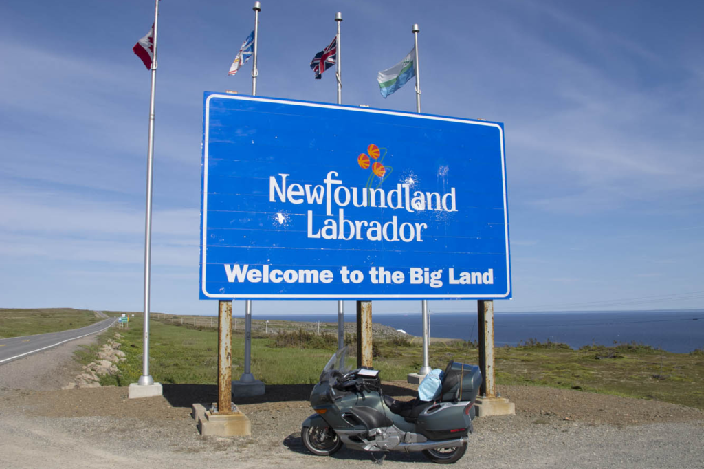
Newfoundland Labrador welcome sign
Coastal Labrador was the next stop.

Newfoundland and Labrador, the easternmost province in Canada, fights a losing battle patching its roadways. Realizing it’s a lost cause, the province simply erects signs along the way warning “Potholes Ahead.” It’s a challenging slalom on a motorcycle, let alone in a car. I watch the suspension jolt on the van ahead carrying my wife and two teenage sons. New struts and an alignment are in order upon our return.
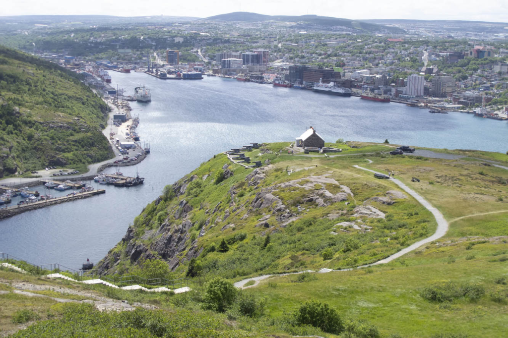
St. John's Harbour
Signal Hill provides a panorama of St. John’s Harbour.

This is a cautionary tale about undertaking a “family vacation” when your family is in a van while you expect to experience the freedom of tagging along on your motorcycle. My wife, Nancy, has the notion of taking a ferry across the strait to coastal Labrador on the mainland to drive the mainly gravel Trans-Labrador Highway after we’ve finished our tour of Newfoundland. I, on the other hand, have serious reservations about adventure biking on my 850-pound beast of a BMW K1200LT, now with more than 200,000 miles on it. So, we will part ways after the ferry crossing to Labrador. And soon thereafter I would learn a bit of humility from some Canadian riders.
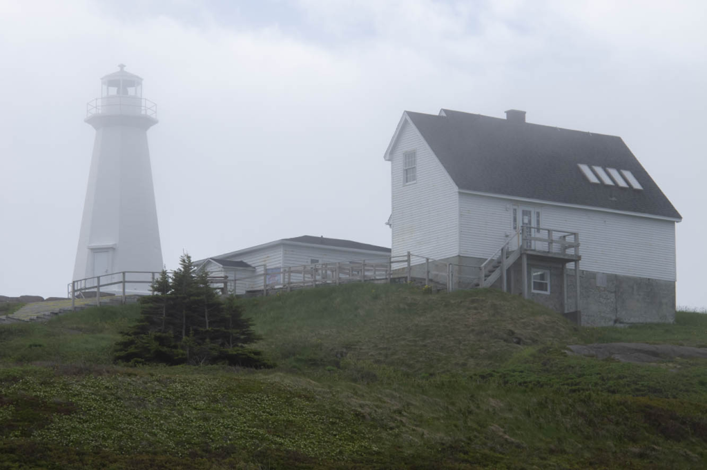
Cape Spear
Fog shrouds a lighthouse at Cape Spear, the easternmost point in North America.

Meanwhile, we have arrived on Newfoundland’s Avalon Peninsula after a 16-hour ocean crossing from North Sydney, Nova Scotia. We enter fog and wind on our southern loop around the peninsula by way of Trepassey Bay, common weather features in this part of the country. But conditions improve at Lord Baltimore’s Colony of Avalon, the best preserved early English colonial site in North America. Archaeologists continue to dig as we tour the area. At the nearby Tetley Tea Room by the Sea, we sample our first Newfoundland cod and wild berry treats.

Nearly 100 lighthouses once peppered the shorelines of Newfoundland and coastal Labrador, and we encounter our first ones at Cape Spear, the easternmost point in North America. One, dating back to 1836, is the oldest surviving lighthouse in the province. The more modern one, erected in 1955, houses an adjacent museum. Here we learn there are 23 staffed lighthouses remaining in the area. In the distance we saw Signal Hill, our next destination.
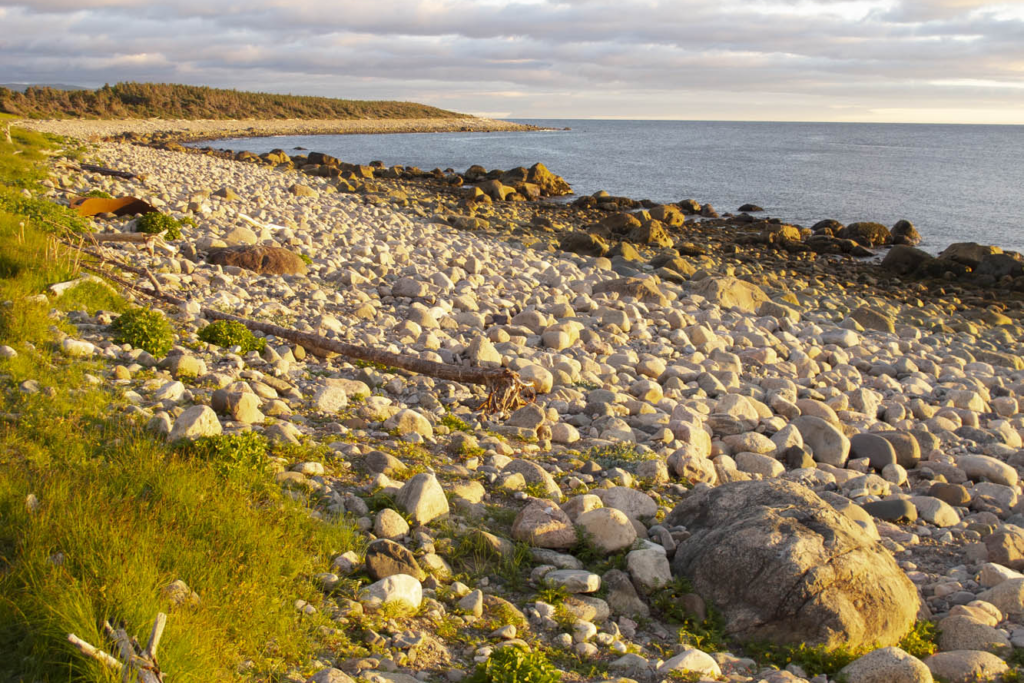
Newfoundland's Northern Peninsula
Twilight gilds the rocky west coast of Newfoundland’s Northern Peninsula.

We negotiated the downtown minefield of St. John’s to reach a better perspective of the city from Signal Hill National Historic Site. The narrow harbor entrance drove many a sailing ship to peril. A colorful regiment of signal corps were practicing for their daily tattoo in front of Cabot Tower, a sandstone Gothic Revival structure begun in 1898 to commemorate the 400th anniversary of Italian John Cabot’s discovery of Newfoundland and the 60th anniversary of Queen Victoria’s reign. Marconi received the first wireless transatlantic transmission here in 1901.

Canadian Signal Corps regiment at Cabot Tower
The Canadian Signal Corps regiment practices at Cabot Tower on Signal Hill.
Iceberg in Smith's Harbour
Icebergs like this one in Smith’s Harbour on the Baie Verte Peninsula float into coves and inlets aided by the wind and tide.

Nancy wanted to explore downtown St. John’s, while I desired to escape Newfoundland’s capital and largest city. Changed my mind at lunch in a rathskeller dive where we were served outstanding cod burgers and I discovered Iceberg Beer. St. John’s Quidi Vidi Brewery claims it is enhanced by pure 20,000-year-old iceberg water. I detect crispness in this pale lager that similar brews lack. Our two boys, both crew rowers, were excited to find out from our friendly waitress that the Royal St. John’s Regatta is North America’s oldest continuing sporting event. That’s appropriate, since St. John’s is the oldest English-founded city on the continent.
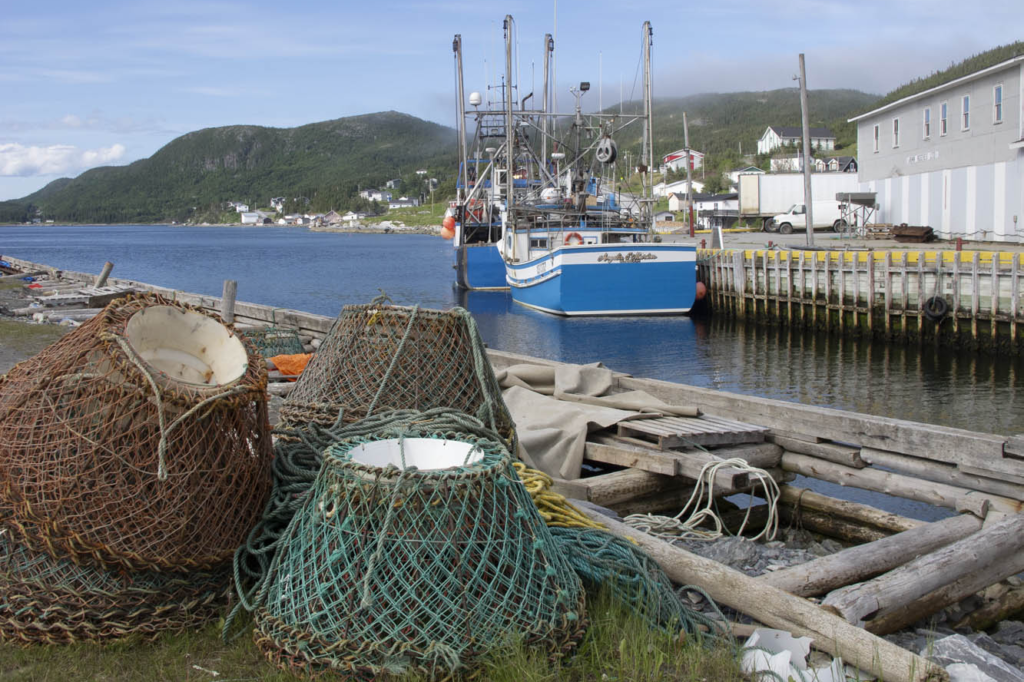
Port au Choix on the Gulf of St. Lawrence
Crab pots and trawlers stand ready at Port au Choix along the Gulf of St. Lawrence.

The Trans-Canada Highway leads us inland through the Eastern Region. Insidious longitudinal potholes jar the unwary. Canadians whoosh by, heedless of the hazard. My shocks are taking a beating, and they were leaking even before this trip. We set up camp at Notre Dame Provincial Park in the Central Region, and I take to the van for exploration around Twillingate. At Boyd’s Cove, we visit the Beothuk Interpretation Centre to learn about the extinct native inhabitants of Newfoundland.

In a tiny outpost called Clarke’s Head, I backed the van into a local’s vehicle at a gas station. “See what trouble I get into when I’m off the bike?” I say to my wife. The Newfoundlander was almost apologetic for being in my way, and we parted in friendly fashion. I can’t imagine that happening back in New York.
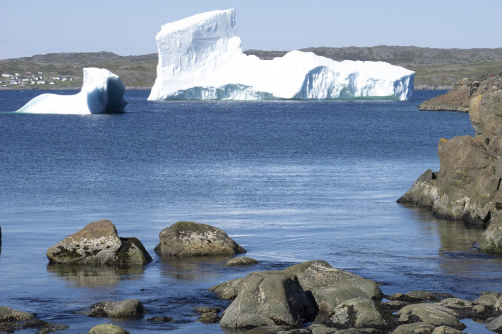
Iceberg Alley
Iceberg Alley extends into the harbor at St. Anthony on the tip of the Northern Peninsula.

I mounted the bike for our next excursion up the Baie Verte Peninsula. The 50-foot skeleton of a humpback whale was worth scrutinizing at King’s Point. On the way to the tip of the peninsula at Fleur de Lys, we diverted to Smith’s Harbour, having learned that a huge iceberg had settled there. Indeed it had, and a picture perfect little place it was. These bergs drift off from the Labrador Current into nearby harbors, bays, and coves brought here by the wind and tide.

Back in the town of Baie Verte we learned about the peninsula’s rich mining history. Indeed, we passed a huge abandoned asbestos mine on the way to Fleur de Lys, where soapstone was quarried by the Dorset Paleo-Eskimo some 1,600 years ago. After reaching the end of the road, we were about to turn around when a pickup raced up and blocked our way.
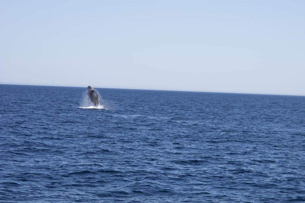
Humpback whale breaches in St. Anthony Harbour
A humpback whale breaches in St. Anthony Harbour on the Northern Peninsula.

The driver turned out to be a friendly local resident who noticed our New York license plates and wanted to chat. Encounters like this were common for us throughout Newfoundland.

So far, our progress was slow. Stopping frequently and visiting the numerous outport villages didn’t accumulate the mileage. Many were the dead-end roads we explored. I reviewed my mileage log once we were in the Western Region: 70 miles one day, 105 miles the next, followed by 90 miles, 62 miles, then zero, zero. Aaaughh!
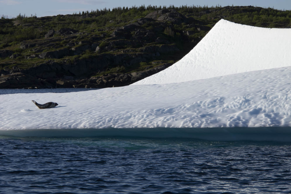
Seal on an ice floe
A seal basks on an ice floe.

I finally rode a 200-mile day from Baie Verte to Trout River campground in Gros Morne National Park. This area is a UNESCO World Heritage Site defined by ancient up-thrust landscape forming the tip of the Appalachian Mountains. The Tablelands region exposes examples of the earth’s mantle. Glaciers carved out a fjord at Western Brook Pond, where we took a boat ride beneath 2,000-foot cliffs. Ice fields cling to crags, offering summer habitat to the caribou and puffins.

If there was a central point to this wilderness, it would be picturesque Rocky Harbour, sheltered by a lighthouse promontory and twin Appalachian ridges dipping into the Gulf of St. Lawrence. The Gros Morne Wildlife Museum in town is worth a look. The Ocean View Hotel displays unique local artwork and hosts the Anchor Pub, where one can be “screeched in” as an official Newfoundlander. The boys were greatly disappointed they weren’t allowed to drink the rum and kiss a codfish. Earl’s restaurant offered moose burgers, moose soup, moose pizza, and any other variety you’d like. We left sated.
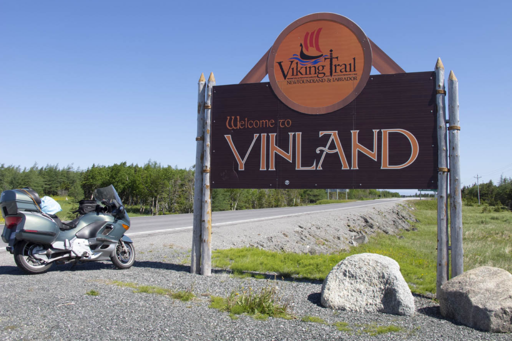
Norsemen sign
Norsemen landed here in 1,000 A.D.

I gave the BMW free reign on Route 430 up the western coast of the Northern Peninsula, a smooth-surfaced road flowing alongside the Gulf of St. Lawrence, with the Long Range Mountains framing the eastern horizon. Felt like being back on Highway 1 in California. This is the Viking Route that would lead us to the first established European settlement in North America at the very tip of the Northern Peninsula. It also has the largest density of moose on the continent, and we had already seen several.

We had fun interacting with interpreters at L’Anse aux Meadows National Historic Site, location of the Viking presence here in 1,000 A.D. We walked through a reconstructed encampment of turf-walled longhouses while re-enactors stayed in character demonstrating the daily life of the Norsemen. Our tour continued at nearby Norstead, a living history site of additional costumed interpreters and a fully replicated Viking ship.
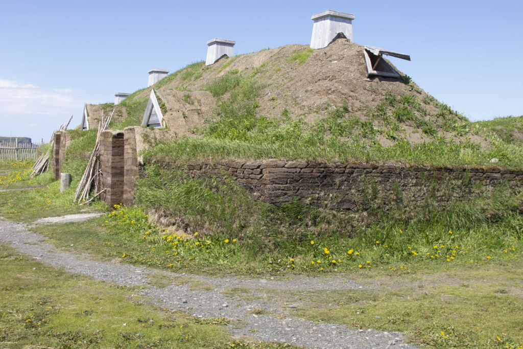
Viking village at L'Anse aux Meadows
Reconstructed sod huts replicate the Viking village as it would have appeared 1,000 years ago at L’Anse aux Meadows.

We hit paydirt in St. Anthony, viewing a harbor filled with icebergs. A boat tour brought us up close to these ice cathedrals. A humpback whale breached for us several times. A pod of minkes came alongside the boat. A seal reclined upon his private ice floe. We absorbed the opportunity, because two days later the icebergs had broken up, which can happen quickly we were told. By mid-July any icebergs become a rare sight.

A ferry took us across the Strait of Belle Isle to coastal Labrador. A 50-mile ride brought me along the strait and over the mountains to Red Bay, a 16th-century Basque whaling port. Red Bay also offers access to the Trans-Labrador Highway, and this is where my family and I parted company. I had reservations aboard a supply ship that routinely sails upstream to replenish harbor towns with no connecting roads along the Quebec coast.
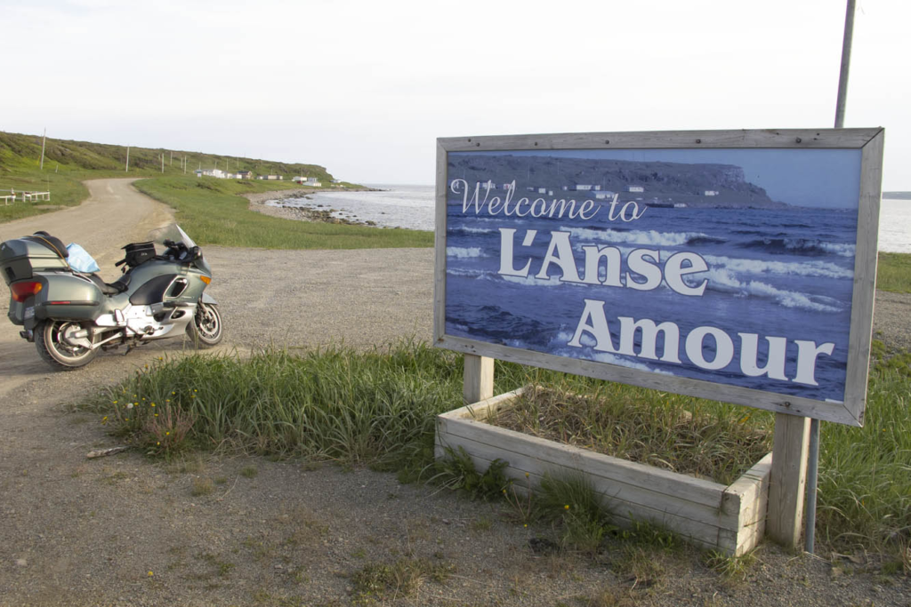
L'Anse Amour welcome sign
Around the promontory in the background of this coastal Labrador village rises Canada’s second tallest lighthouse and an ideal spot for whale watching.

I returned to the ferry landing at Blanc-Sablon, Quebec, and lined up with other motorcyclists early on a rainy morning. The bikes were loaded two to a container, tied down, and hoisted by a mammoth boom crane into the vessel. Two Honda ST1300 riders humbled me because they had just completed the Trans-Labrador trek. We would disembark where the road begins anew in Natashquan. Or so we thought.

Circumstances changed upon reaching the village prior to Natashquan hours behind schedule. We all had reserved respective B&B inns in Natashquan, where we wouldn’t arrive now until the wee hours of the morning. We learned there was indeed a 20-mile road from the village to Natashquan, but it was all gravel. Nonetheless, all riders, except me, decided they would disembark here and risk the unfamiliar road in the midnight blackness.
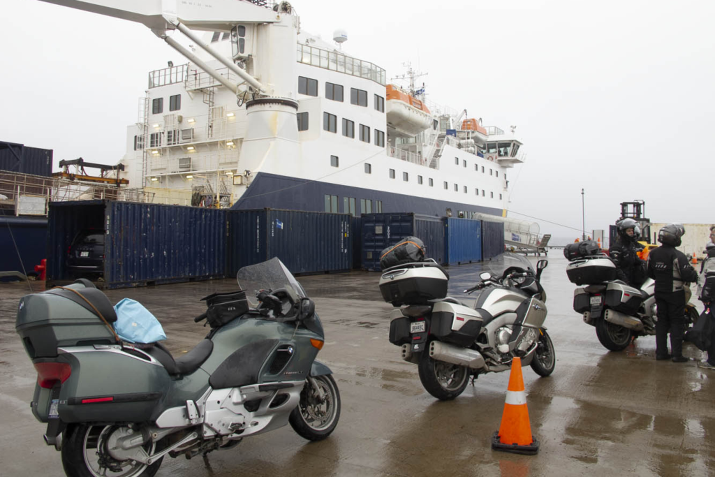
Motorcycle supply ship
Riders lined up for loading into the supply ship heading up the Gulf of St. Lawrence and coastal Quebec.

Now, I’ve ridden my share of gravel roads, I told them. Even did the 1,200 miles of Alaska Highway when it was unpaved. But I was much younger and more fearless. My concern today was dropping my precious K1200LT, resulting in thousands of dollars in cosmetic damage. But my bike shared a container with one of theirs, and all looked askance at my weak rationalization. To regain self-respect, I agreed to accompany them.

It turned out to be the most anxiety-inducing 20-mile ride of my life. Inky blackness and bunched gravel had me plowing from one side of the road to the other, trying to find a tractable groove. It didn’t help that I was reluctant to get the speed up. One of the Canadians on his Kawasaki Tengai remained behind me for assurance, urging me to stand on the pegs and go faster, while the rest shot ahead. Such humiliation, I thought. When we finally caught up, the group was parked at a pullout on the outskirts of town.
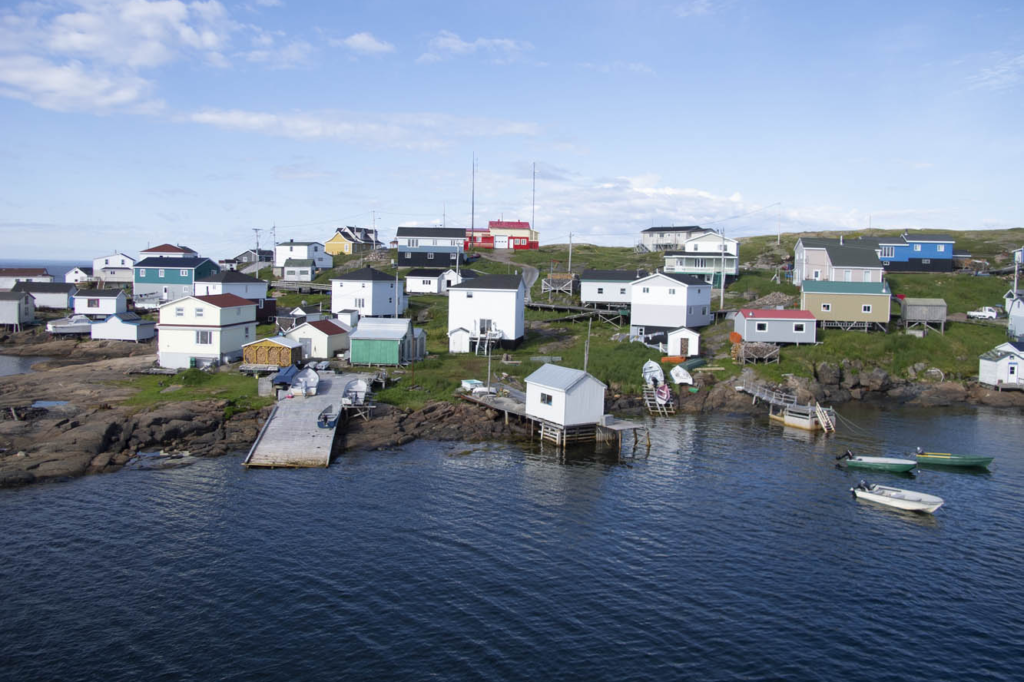
Harrington Harbour was one of our supply ship’s many stops to replenish ports along coastal Quebec not connected by any roads.

“How’d he do?” asked one of his Canadian co-riders.

After a slight pause and a sly smile directed at me, he replied, “Slow, but steady.”

And with that turn of phrase, my newfound Canadian friend preserved my dignity, eliciting congratulatory backslapping and an acknowledgment of a successful ride all-around by the French-Canadians in a language universally understood.

The next day, while imagining my wife and boys bouncing along the rutted Trans-Labrador – views blocked by boreal forest and swatting at clouds of black flies – I rode 390 blissful miles of coastal Quebec. Open-road freedom never felt so good.

The post On the Road: Newfoundland first appeared on Rider Magazine.
Source: RiderMagazine.com

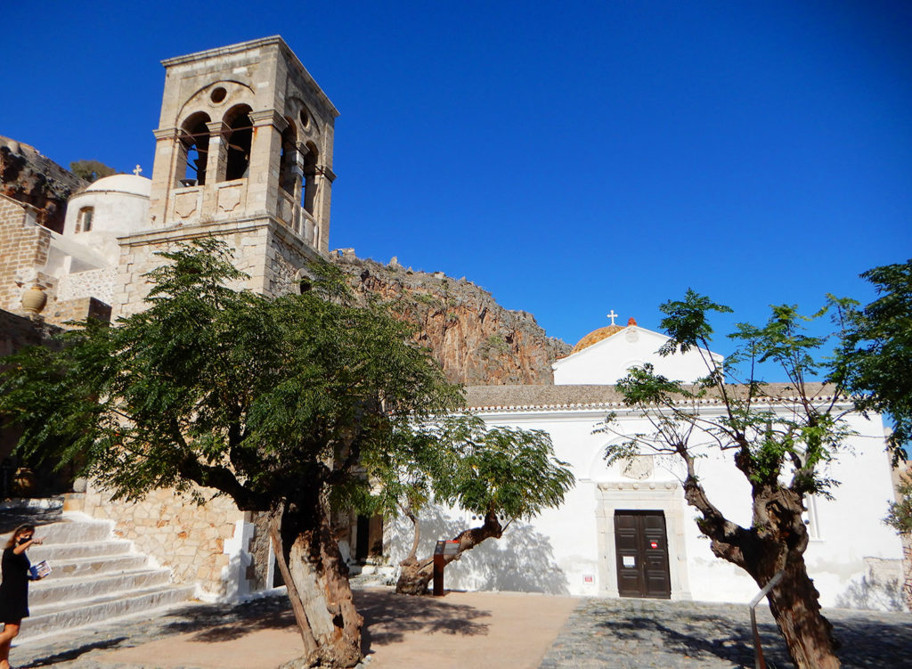
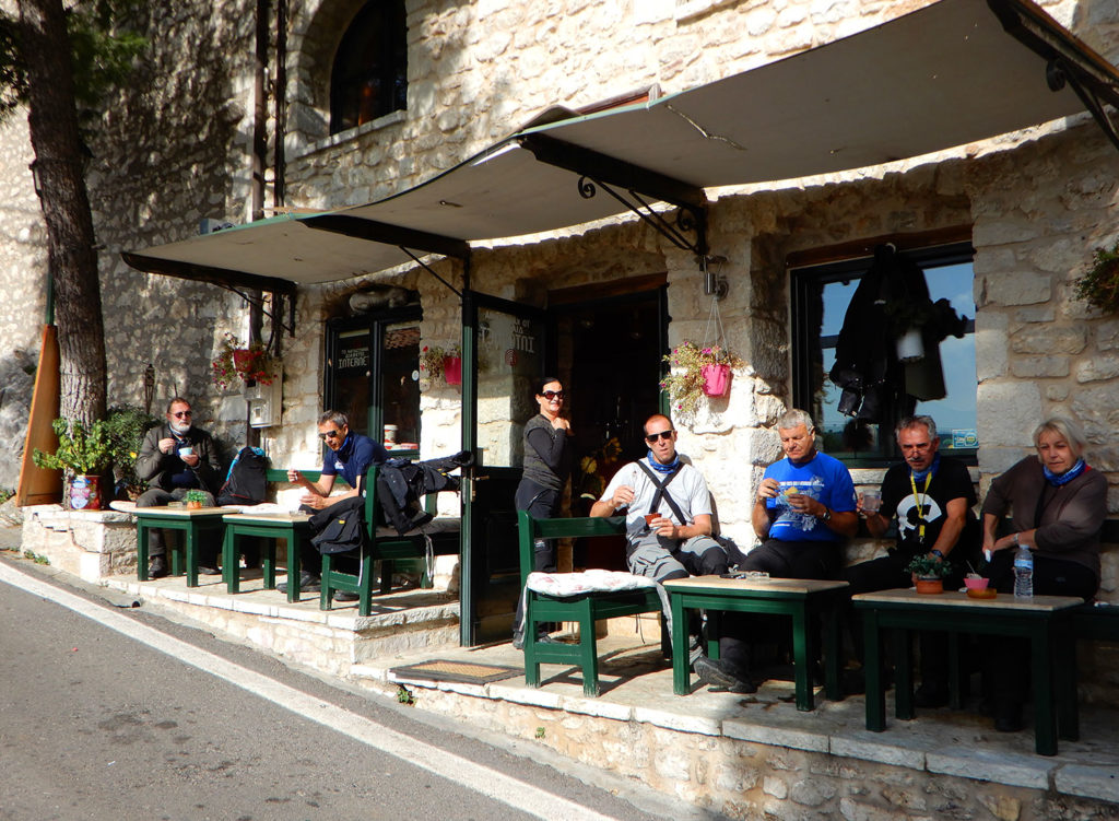
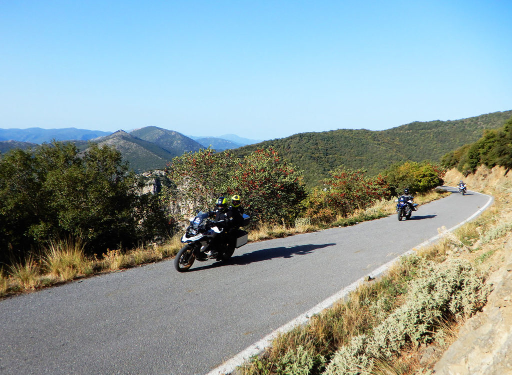
Rider Magazine Best of Greece Tour with Edelweiss Bike Travel

Rider Magazine Best of Greece Tour with Edelweiss Bike Travel

Greece has always been on our motorcycle bucket list. According to Rainer Buck, Managing Director of Edelweiss Bike Travel, Greece is one of his top 3 riding destinations in the world. He says it’s “like a mountain range was dropped into the sea.” Join us for the Rider Magazine Best of Greece Tour with Edelweiss Bike Travel, a 14-day tour scheduled for May 15-28, 2022.

Information about the tour is included below, and a special booking page is accessible HERE. Pricing starts at $7,190 per person.

And you can book without worry — if things change, you can rebook or get a refund. See the Edelweiss coronavirus policy for more information.

Rider Magazine Best of Greece Tour with Edelweiss Bike Travel

Ancient Greece is the cradle of our civilization, our culture and society. Countless words that we use every day are derived from Greek, such as car, cosmos, democracy, atmosphere, politics, telephone, anesthesia and panorama, to name just a few. The ancient Greeks not only influenced science, art and literature, they practically invented them.

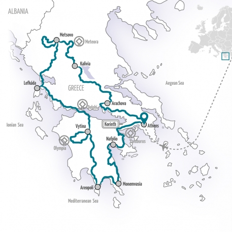
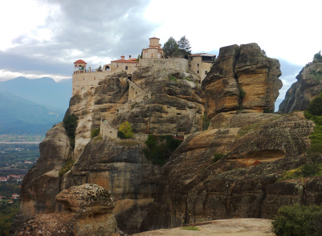
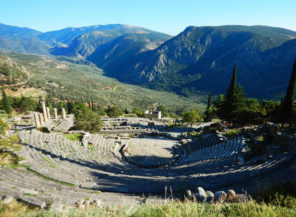
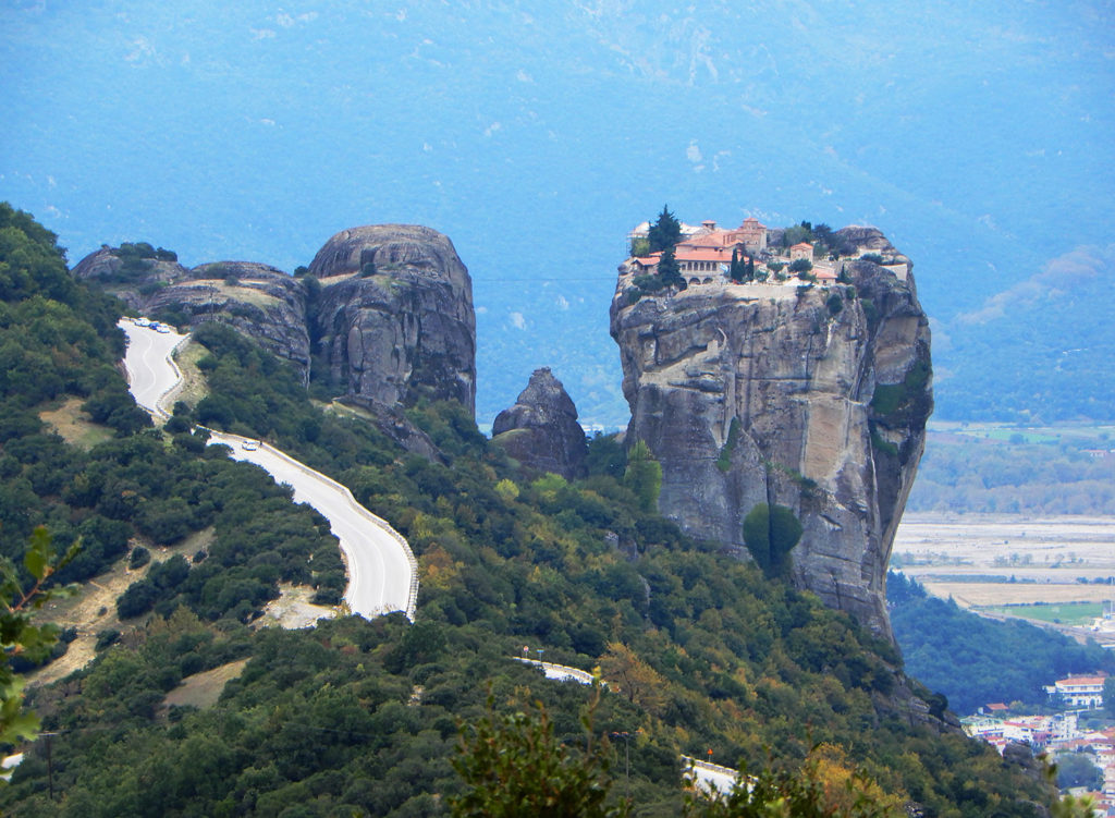
Athens, the capital, is filled with history, monuments and memorials like no other city in the world. Except Rome maybe, but this is a different tour. On this tour here you will experience some of the great attractions of Greece, such as Delphi, Olympia and the Meteora monasteries. But also gems, that not every traveler will find, are on the program, such as the Pindos Mountains or the enchanting mountain village Vytina, where we will even spend two nights.

In the 14 days you will get to know everything that defines real Greece: 3,000 years of culture, stunning nature, excellent food and extremely friendly people, not to mention the always beautiful weather and the wonderfully winding, mostly empty and always panoramic roads who really enjoy riding a motorcycle. And every time you sit in a kafenion and enjoy your espresso, you can look forward to being on tour in a paradise like Greece. If the ancient Greeks only knew …

Rider Magazine Best of Greece Tour with Edelweiss Bike Travel
  • START/FINISH: Athens
  • NEAREST AIRPORT: Athens
  • DURATION: 14 days vacation, 12 riding days
  • ROUTE: Total distance: 1,473-1,832 miles; Daily distances: 90-348 km, 56-216 miles
  • REST DAYS: Metsovo, Vytina, Agios Stefanos
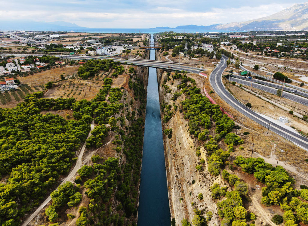
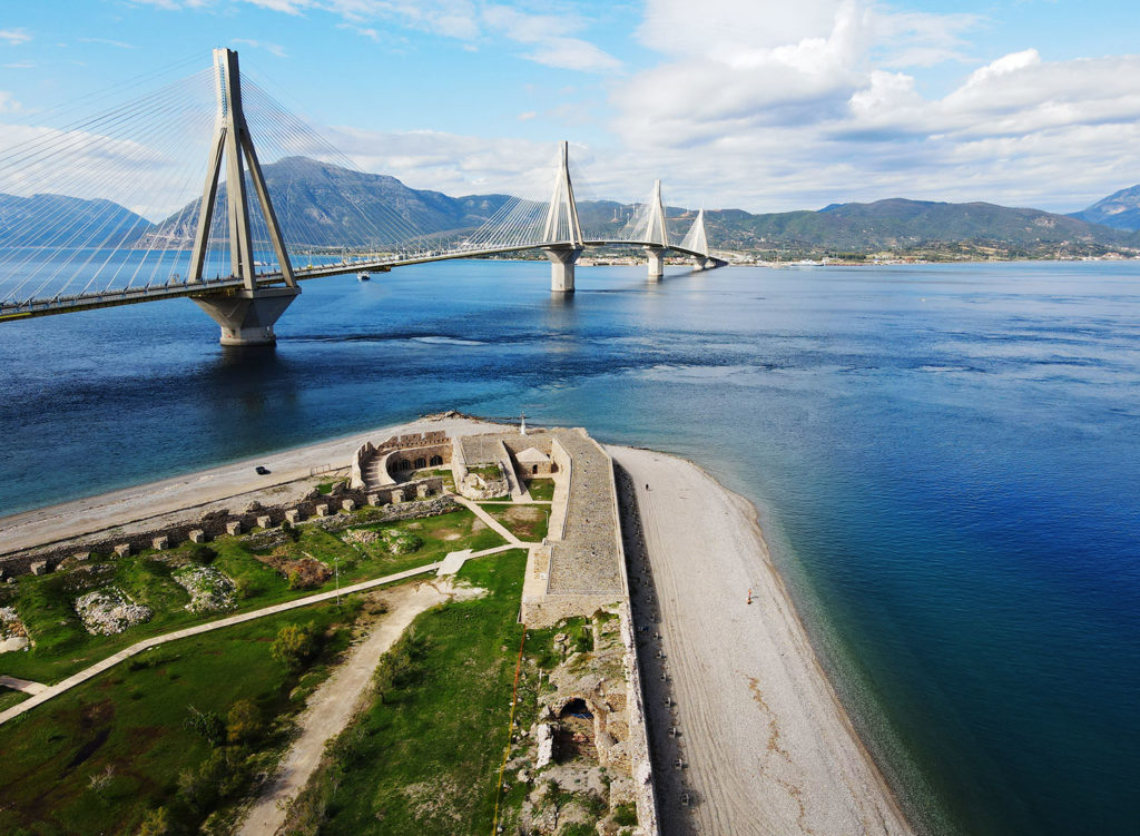
  • HIGHLIGHTS: unique evidence of high Greek culture such as Delphi, Olympia or the amphitheater of Epidaurus, Athens with its inexhaustible culture and history, the dizzying Meteora monasteries built on high cliffs, the super bridge over the Gulf of Corinth, the beautiful island of Lefkada
  • MINIMUM NUMBER OF PARTICIPANTS: 6 (Please note paragraph 4.2. a) of our terms and conditions of travel to find out more about the cancellation of tour through Edelweiss Bike Travel when the minimum number of participants is not reached – Terms and Conditions)
  • FOR MORE INFORMATION: Visit the “Best of Greece” tour page
  • SPECIAL RIDER MAGAZINE TOUR BOOKING LINK: https://www.edelweissbike.com/ridermagazinegreece
  • COVID-19 POLICY: https://www.edelweissbike.com/en/coronavirus
  • Read our past reviews of Edelweiss Bike Travel tours:

The post Rider Magazine Best of Greece Tour with Edelweiss Bike Travel first appeared on Rider Magazine.
Source: RiderMagazine.com

The New Edelweiss Bike Travel Program 2022 – Packed with Motorcycle Adventures Worldwide

Edelweiss Bike Travel 2022 Brochure

With a loud thud it falls on your doormat: the brand new, and especially thick, motorcycle travel brochure from Edelweiss Bike Travel.

With over 40 years of experience in motorcycle travel, Edelweiss knows how to offer you the best routes and destinations. The 198-page brochure gives extensive information about the tours on all continents, details about the level of difficulty, average riding time, and average sightseeing time. In addition to guided tours, they offer self-guided tours and scooter tours.

Do you have a ton of free time? Then you can join the completely guided world tour, which goes from Munich to Bali, for example. For the off-roaders, there is a category with unpaved tours on 3 different continents. And if you book now until October 31, 2021, you get a $250 discount on one of the tours from the standard program for 2022. The discount code is EBB2022.

If you haven’t ordered one yet, the brochure is completely free of charge to order or download on the Edelweiss Bike Travel website. Visit www.edelweissbike.com to claim yours.

The post The New Edelweiss Bike Travel Program 2022 – Packed with Motorcycle Adventures Worldwide first appeared on Rider Magazine.
Source: RiderMagazine.com
Romania to Istanbul Adventure

Romania to Istanbul Adventure with Adriatic Moto Tours
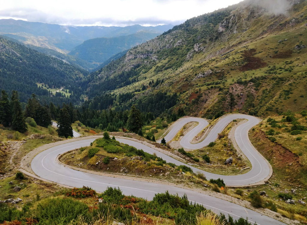
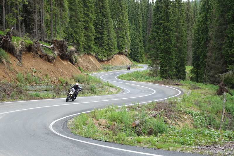
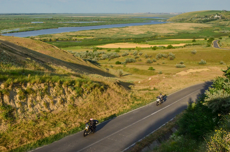
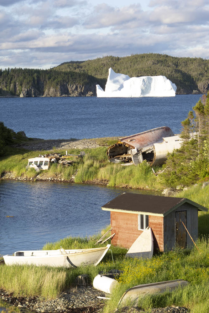
Riding the Transalpina Road in the Carpathian Mountains. There were many roads like this on the Romania to Istanbul Adventure with Adriatic Moto Tours. (Photos courtesy of Adriatic Moto Tours)

Trying to summarize a 14-day motorcycle tour through Romania, Bulgaria, Greece and Turkey, with all of the roads and meals and people and historic sites that it entailed, in about 1,000 words is like trying to stuff 10 pounds of rice into a 5-pound sack. Adriatic Moto Tours’ Romania to Istanbul Adventure tour lived up to its name, providing a dozen of us — four Australians and eight Americans — with a rich experience in a very interesting and beautiful part of the world.

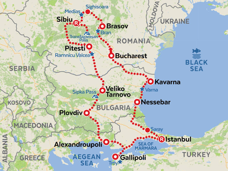
Our tour began in Bucharest, Romania, and followed a counterclockwise loop with overnight stops in charming towns and rest days in Sibiu, Romania, and Istanbul, Turkey.

Romania to Istanbul Adventure with Adriatic Moto Tours
Our tour route started and ended in Bucharest. You meet the nicest people in Transylvania. And ride some of the best roads. Enjoying a late afternoon ride along the Danube River.

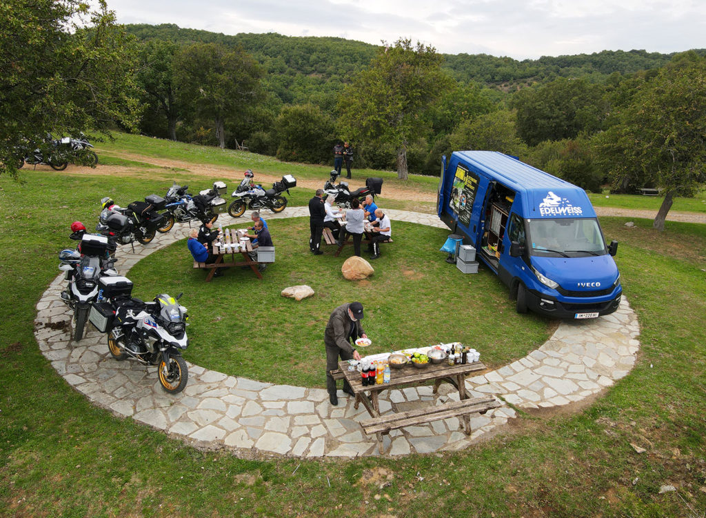
Before our trip, Adriatic Moto Tours (AMT) sent us a detailed tour guide book and a map, and they made our hotel arrangements in Bucharest and picked us up at the airport. All my wife Becky and I had to do was pack our gear and make sure we made our flight. Orientation, bike assignments and everything was stress-free, and after our first dinner together our group was acquainted, bonded and ready to ride.

RELATED: Adriatic Moto Tours’ Intriguing Southeast Europe Tour

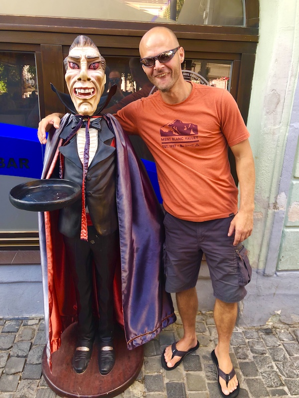
Rok was our motorcycle guide and Primož was our support van driver and evening host. From Burcharest we made our way to Târgovişte, where we enjoyed coffee and fresh pastries at a café adjacent to an imposing 15th century fortress. Vlad Dracula, also known as Vlad the Impaler and the inspiration for the vampire Dracula, fought bloody battles here. Primož told us that Vlad once invited hundreds of guests to a banquet, then had them all killed and impaled.

Romania to Istanbul Adventure with Adriatic Moto Tours
Meeting Count Dracula in Târgovişte, Romania

On that cheery note, we rode north toward Câmpulung into delightful mountains, with rocky peaks in the background and gorgeous green pastoral scenery below. This stretch was winding and curvy but smooth and pleasant. There are many beautiful places in the world, all different, but there aren’t many that are more beautiful than this section of Romania’s Carpathian Mountains. We visited Bran Castle, which was built in the 13th century and inspired Bram Stoker’s description of the vampire’s castle in “Dracula.” On the way to dinner that night, Primož led us on a walking tour of the old city in Braşov. Each night we walked to a wonderful restaurant, and the guides shared their wealth of knowledge about the culture and history of the area. Dinners were family-style, with Rok and Primož ordering a variety of platters so we could sample a little bit of everything.

Romania to Istanbul Adventure with Adriatic Moto Tours
Enjoying a late afternoon ride along the Danube River.

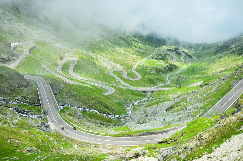
Our route continued through Transylvania on smooth roads through rolling hills, the terrain and scenery constantly changing. We had lunch in Sighişoara, a walled 12th century town that’s a UNESCO World Heritage site. For our “rest” day in Sibiu, we did what riders do — we got up early and headed out on a ride, in this case to the renowned Transfăgărăşan road over the Făgărăş range. At the base of the mountain, Rok gave the signal and the group broke apart with everyone riding their own pace up the steep twisty switchbacks to the pass at 6,699 feet. The next day, after finding out that a rockslide had closed the highly anticipated Transalpina Road, we assuaged our disappointment with another run on the Transfăgărăşan.

Romania to Istanbul Adventure with Adriatic Moto Tours
The legendary Transfăgărăşan road in Romania is so good, we rode it twice.

We crossed the Friendship Bridge into Bulgaria and made our way to Veliko Tarnovo, where we spent the night in the Tsarevets Fortress. We visited the Shipka Monument at a 3,900-foot mountain pass that was the site of battles during the Russo-Turkish War in the late 1800s. And we descended into Rose Valley, where much of the world’s rose oil for perfumes comes from, and passed sunflower fields that stretched as far as the eye could see.

After a night in Plovdiv, which has Roman ruins in the center of town, we rode through the Rhodope Mountains into Greece. Most of the road had excellent pavement, smooth curves and gorgeous mountain terrain that gave way to Mediterranean seaside scenery at Alexandroupoli. The next day we crossed into Turkey, and a perfect arc of roadway around the Gulf of Saros took us to tip of the Gallipoli Peninsula, where we visited WWI memorials.

Romania to Istanbul Adventure with Adriatic Moto Tours
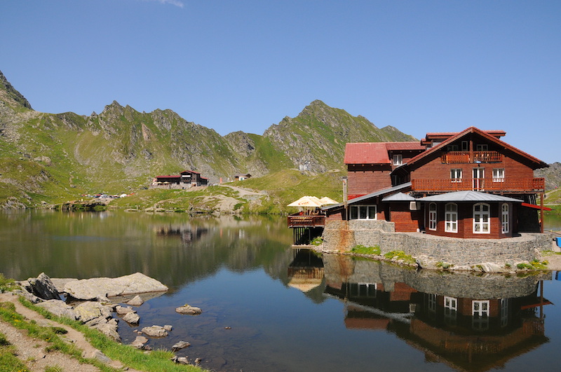
Balea Lac at the top of the pass on the Transfăgărăşan road through the Făgărăş Mountains.

Istanbul is beyond words. As the crossroads of the East and West, it has a rich, varied history and a unique mix of cultures. Three nights and two rest days in Istanbul allowed plenty of time to explore and see famous sites like the Blue Mosque, Hagia Sophia and the Hippodrome of Constantinople. People on the streets and in shops were warm and friendly, and the variety of foods was endless and always delicious. Our hotel provided easy access to historic areas, and its rooftop restaurant and bar overlooked the Bosphorus Strait, which is the boundary between Europe and Asia. Just indescribable — you really should experience it for yourself.

After the sensory overload of Istanbul, we followed Rok northwest to our lunch stop at Saray. The roads zigged and zagged, and the surface was somewhat rough due to years of being patched. We crossed the border back into Bulgaria, and at the checkpoint there were several luxury vehicles shot full of hundreds of holes. If that was meant as a warning, it worked. Nessebar, situated on a rocky peninsula jutting into the Black Sea, was our stop for the night. It’s one of the oldest towns in Europe, and as we walked to dinner we saw monuments and ruins dating back to the 5th century. The atmosphere in the twilight was breathtaking, another step back in time.

Romania to Istanbul Adventure with Adriatic Moto Tours
One of the endless fields of sunflowers in Bulgaria.

The terrain and scenery changed yet again as we rode north along the Bulgarian coast, which is a popular vacation destination with dramatic cliffs, pristine beaches and resort hotels. After a night in Kavarna, where we stayed in a modern condo overlooking the Black Sea, we rode through fertile grain-producing agricultural areas. We crossed back into Romania on a ferry over the mighty Danube River and made our way back to Bucharest, where Primož greeted us with champagne at the hotel. After celebrating, we emptied the bikes and got cleaned up for the farewell dinner. I don’t remember much about that final night. Our heads were spinning with memories, laughter and a few adult beverages.

This tour was everything we could have imagined, multiplied by a factor of 10. Both guides worked tirelessly to accommodate us every day for 14 long days. The riding was great, the scenery ever-changing, the history and culture beyond what we could absorb in a lifetime, and Adriatic Moto Tours earned our highest regards for everything from the booking to the final hoorah. Maybe we can go again someday?

Romania to Istanbul Adventure with Adriatic Moto Tours
Our group of intrepid adventurers.

AMT’s Istanbul to Romania Adventure tour runs several times a year from August to October. For dates, pricing and details, visit adriaticmototours.com.

The post Romania to Istanbul Adventure first appeared on Rider Magazine.
Source: RiderMagazine.com
Mystical Morocco: Edelweiss Bike Travel’s Morocco Tour

Ducati Morocco ride
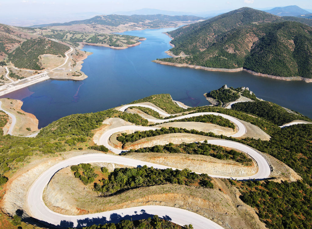
Fast, comfortable and oh-so red, a Ducati Multistrada 950 from Edelweiss’ rental fleet was an ideal choice for the Morocco Tour. Behind it is the Ounila River valley and Aït-Ben-Haddou, a 17th century “ksar” (fortified village) on the old trading route between Marrakesh and the Sahara Desert. Considered an outstanding example of southern Moroccan mud-brick architecture, it has been a UNESCO World Heritage Site since 1987 and a filming location for many TV shows and movies such as “Game of Thrones,” “Gladiator” and “The Mummy.”

Morocco is one of those places that seems both familiar and unfamiliar. We’ve heard of cities like Fez and Marrakesh, and most of us can imagine their crowded, maze-like bazaars full of merchants hawking rugs and spices. Perhaps we’ve eaten couscous or tagine in a Moroccan restaurant or watched “Casablanca” a few times. But, unless we’ve been there, what we know is just bits and pieces of a rich and varied country full of hidden delights.

Located along the Atlantic and Mediterranean coasts of northwest Africa — and separated from Spain by just nine miles at the Strait of Gibraltar — Morocco has incredibly diverse topography, scenery and culture, with a mix of Berber, Arab, African and European influences. Inhabited for tens of thousands of years, Morocco has been occupied by Phoenicians, Berbers, Romans, Muslims and, during the first half of the 20th century, the French and Spanish. Independent since 1956, the Kingdom of Morocco is a constitutional monarchy with an elected parliament, Islam is its predominant religion and, by regional standards, it is politically stable and economically prosperous.

Morocco street signs
Some signs in Morocco are in three commonly spoken languages: Arabic (top), Berber (middle) and French (bottom).

The Atlas and Rif mountain ranges dominate much of Morocco, with the Atlas forming an east-west barrier that separates the temperate Mediterranean climate to the north from the arid desert climate to the south. During Edelweiss Bike Travel’s 13-day Morocco Tour, we rode along craggy coastlines, up and over rugged mountains, through deep, narrow river gorges and across desolate desert valleys. We wandered the medinas (old quarters) of Fez and Marrakesh, explored the blue-painted alleys of Chefchaouen, visited the largest mosque in Africa and rode camels across sand dunes for a night of camping in the Sahara Desert, visiting several UNESCO World Heritage Sites along the way. I’ve been on a dozen overseas motorcycle tours on five continents, and Morocco offered the best variety of roads, scenery, food and experiences of them all. 

First, we had to get there.

Edelweiss motorcycle tour Morocco
A map of the tour route.

The tour starts and ends in Málaga, on Spain’s southern coast. After the first night’s welcome briefing, bike hand-over and dinner, we geared up and made our way southeast along the Costa Del Sol, scrubbing the sides of our tires on the winding road up to Ronda, one of Spain’s best motorcycling roads. We spent the afternoon in Gibraltar, a British Overseas Territory at the southern tip of the Iberian Peninsula, enjoying views from its massive, 1,400-foot limestone promontory and snapping photos of its tourist-friendly population of monkeys. A ferry ride across the strait took us to Cueta, an autonomous Spanish city on the northeast tip of Morocco.

Gibraltar monkey
Monkeying around on the Rock of Gibraltar.

Our second day started with a hurry-up-and-wait crossing of the high-traffic border, a process handled with aplomb by our multilingual guide Angela, who has led more than 20 tours in Morocco. After several miles on a manicured boulevard lined with resorts and shopping malls, we hugged the coast on a dramatic road high above the Mediterranean. After a seafood lunch overlooking the sea, we turned inland, twisting through the Laou River canyon that forms a deep rift in the Rif Mountains.

The richness of Morocco was on full display in Chefchaouen, a 15th-century town perched on a mountainside with many of its buildings painted various shades of blue. As we explored the narrow, winding alleyways of the “souk” (marketplace) in the medina, artwork, rugs, clothing, spices and trinkets spilled onto the cobblestone walkways and steep stairs, some corridors barely wide enough for two people to pass. At dusk we heard “adhan,” the Islamic call to prayer recited five times a day by muezzins via loudspeakers atop mosque minarets. With mosques scattered throughout Chefchaouen, adhan creates a loud Arabic chorus that can be heard citywide. The next morning I was awoken by the call to prayer well before sunrise, followed by howls from dozens of dogs.

Ducati Morocco ride
The blue buildings and alleys of Chefchaouen.

Our itinerary included two nights in Chefchaouen at two different hotels, one at the beginning of the tour and another 10 days later after making a counterclockwise loop around Morocco. From Chefchaouen we rode southwest, out of the Rif Mountains and across fertile plains to Mohammedia on the Atlantic coast. Our group was large, with 17 participants, three guides, 16 motorcycles and one support van. After each morning’s ride briefing, we split into two groups and left about 30 minutes apart, meeting up at coffee and lunch stops. From Mohammedia, one group rode into Casablanca to tour the massive Hassan II Mosque, which has a 690-foot minaret that looms over the city’s waterfront. The rest of us rode farther down the coast to El Jadida, a port city that includes the walled village of Mazagan, a fortified supply depot built by the Portuguese in the 16th century.

For our rest days in Marrakesh and Fez, Edelweiss hired a local guide who gave us a walking tour of each city’s medina. With its dark, narrow corridors full of stalls displaying produce and meat, leather goods, metalwork, ceramics, rugs, jewelry, artwork, clothing, you name it — each one with a vendor enticing you inside (“Hello my friend, you buy something?”) or haggling with a patron — the medina in Marrakesh is a high-calorie feast for the senses. Our guide Ahmed knew the complex warren like the back of his hand, leading us to a museum of carpet weaving and artisans’ workshops. We returned that night to find the medina’s wide-open plaza brightly lit and full of people, food vendors and performers.

The souk in Marrakesh.
The souk in Marrakesh. Photo by Dieter Arnoth.
A snake charmer and cobra in Marrakesh.
A snake charmer and cobra in Marrakesh. Photo by Dieter Arnoth.
Marrakesh medina souk
The medinas in Marrakesh and Fez are a sensual feast any time of day, but they’re especially vibrant at night, a true kaleidoscope of sights, sounds and smells.

The riding experience kicked into high gear as we left Marrakesh, climbing into the High Atlas, summiting a 7,415-foot pass called Tizi n’Tichka and barreling down the Ounila River valley, its corridor of green surrounded by multicolored canyon walls. We spent the night in a small village at Riad Ksar Ighnda, built in the traditional “riad” style with mud-brick walls surrounding a large inner courtyard, this one catering to tourists with lush gardens, a heated saltwater pool and a bar stocked with ice-cold Casablanca beer. Accommodations on this tour are comfortable, mid-to-high-end hotels catering to English-speaking tourists (the most common languages in Morocco are Arabic and French). Nearly all serve alcohol and have swimming pools, both welcome indulgences at the end of full riding days. The tour includes breakfast and dinner buffets at the hotels, while lunches are at local spots along the route that offer more interesting cuisine.

Throughout the 1,800-mile tour we traveled on paved roads, though in some rural or mountainous areas they were of poor quality or under construction. Outside of cities traffic was light, but sharing the road with horse-drawn carts, mopeds, tuk-tuks, dogs, donkeys or camels was common. Big motorcycles are rare in Morocco; whenever we rode through villages my left arm got tired from waving back to everyone, especially kids, who waved to us.

Edelweiss motorcycle tour Morocco
Our tour guide Angela delighted a group of girls with her bright red Ducati.

The most dramatic scenery was through the Dadès and Todras gorges that cut into the Atlas Mountains. After winding our way through villages along the edge of the Dadès River valley, we enjoyed a picnic lunch hosted by our guides. Then the real fun started. We burrowed deeper into the gorge, its walls closing in and looming higher until we climbed a famous set of switchbacks that took us to the upper gorge. Continuing on, the gorge squeezed down to a single-lane slot before opening up again. The best part was turning around and riding back out the way we came! After a night in a luxurious hotel perched on a hill above Boulmane Dadès, we rode farther east and into and back out of the Todras Gorge.

Edelweiss motorcycle tour Morocco
Our tour guides hosted two picnic lunches in scenic locations. This one was in the Dadès Gorge, and the sandstone in the background is the remnant of an ancient coral reef when the area was under the sea millions of years ago.
Dadès Gorge switchbacks Morocco
The switchbacks that climb their way up through the Dadès Gorge is perhaps the most famous section of pavement in Morocco.

Although the area of Morocco south of the Atlas Mountains has a desert climate, only a narrow sliver of the country near the Algerian border is technically part of the Sahara. We rode into the world’s largest desert on our eighth day, with most of our group riding north to Erfoud for a rest day by the pool at the Hotel Kasbah, and eight of us going to Merzouga for a two-hour camel ride through Erg Chebbi dunes and night in a Berber-style camp.

Riding camels through the Erg Chebbi dunes on our way to a Berber camp in the Sahara.
Erg Chebbi dunes
The glow from the Berber camp where we spent the night on the edge of the Erg Chebbi dunes. Photo by Dieter Arnoth.

During our late fall tour we enjoyed day after day of sunny skies and pleasantly warm temperatures. As our route turned north, we rode through the Ziz River canyon, up and over the High Atlas and across a wide plain. The cool, sunny morning turned into a cold, foggy, rainy day as we traversed the Middle Atlas, over 7,145-foot Col du Zad, through cedar forested national parks and past ski resorts.

We dried out during our final rest day in Fez, where Ahmed led us on a tour of a ceramics cooperative, the foul-smelling leather dying district and other parts of the medina. That night several of us had camel burgers for dinner! Our route back to Chefchaouen took us back into the Rif Mountains on a road that could easily be mistaken for one in the Alps, and before we knew it we were crossing the border, ferrying across the strait and putting our kickstands down back in Málaga, our hearts and minds overflowing with new experiences, memories and stories. If you’re the curious sort who’s ready for an exotic adventure, put Morocco on your list. 

Edelweiss Bike Travel’s Morocco Tour normally runs March/April and October/November. Visit edelweissbike.com for details.

Edelweiss motorcycle tour Morocco
Jürg and Beatrice are followed by Freddy and Monika, two couples from Switzerland winding their way through the scenic Ounila River valley.
Edelweiss motorcycle tour Morocco
Our group of three guides and 17 participants was a friendly group of folks from Germany, Spain, Switzerland and the United States.

Source: RiderMagazine.com
Adventurous Streak: Adriatic Moto Tours’ Intriguing Southeast Europe Tour

Adriatic Moto Tours Intriguing Southeast Europe motorcycle tour
The Intriguing Southeast Europe tour is a rider’s paradise, with exploring the region’s beautiful and lightly traveled roads taking priority over sightseeing. With an open attitude and a sense of adventure, it will be two weeks you’ll never forget. Photos by the author unless otherwise noted.

The Balkan region has had a hand in world history more often than you might think. Thanks to its geographical position, it’s always been a crossroads of culture, where farming first spread from the Middle East into Europe during the Neolithic era, and as the convergence point of Latin and Greek influence, Orthodox and Catholic Christianity, and Islam and Christianity. It’s been home to Goths, Huns, Slavs and Ottoman Turks, among many others.

For riders with an adventurous streak, the Balkans are also a fascinating place to explore, well off the beaten tourist track, where surprisingly entertaining roads with very little traffic will carry you through magical forests, along jade-colored rivers, over high mountain passes and past farm fields where workers still till the soil by hand. I first traveled to the Balkans with Adriatic Moto Tours (AMT) in 2017 (read about that here), visiting Slovenia, Bosnia and Croatia, and was smitten by the culture, history, friendly people and, most importantly, the amazing roads. So this time I opted for a longer, even more adventurous getaway that would complete my tour of the former Yugoslavia — Serbia, North Macedonia and Montenegro — as well as allow a visit to two “behind the Iron Curtain” countries, Bulgaria and Albania, and a unique opportunity to get a passport stamp from a rather controversial country, Kosovo.

Adriatic Moto Tours Intriguing Southeast Europe motorcycle tour
The 15-day Intriguing Southeast Europe tour loops out of Belgrade, Serbia, with rest days in Sofia, Bulgaria; Ohrid, North Macedonia; and Sarande, Albania.

The Intriguing Southeast Europe tour begins and ends in Belgrade, Serbia, a bustling city that sits at the confluence of two mighty rivers, the Danube and the Sava. I arrived a day early to acclimate and explore the city on my own, which I highly recommend. Belgrade, like most European cities, is very walkable and there are several interesting museums and points of interest, including an air museum that features pieces of a U.S. F-117 stealth fighter and an F-16 that were shot down during the 1999 campaigns, a monument to the Jewish and Roma victims of a Nazi concentration camp that once sat on the riverbank (Yugoslavia was occupied by the Nazis during WWII but its people resisted valiantly and were ultimately successful in driving them out) and the Museum of Yugoslav History, burial place of dictator Josip Tito. Most of the people I interacted with spoke English, and all were friendly.

The Serbs that I met tended to be very open and matter-of-fact, and it’s clear the events of 1999 are still quite fresh in their memories. At dinner the first night, only hours after I’d arrived, two young men at the next table overheard me speaking English and they turned and introduced themselves. “I am a riverboat captain,” said one proudly. “It’s good money, more than fifty thousand per month.” He meant 50,000 Serbian dinar, which is equivalent to approximately $475. He then went on to give me his opinions on why Serbia was struggling economically and how strong Yugoslavia once was. He thought the U.S.-led NATO bombing was unethical and misguided. At the end of our conversation, he and his companion warmly bid us good night and bought us a round of drinks. If only all discussions were so civilized.

Adriatic Moto Tours Intriguing Southeast Europe motorcycle tour
With AMT’s guides, knowing the local language isn’t a necessity, and many signs in the bigger towns and cities also included English, indicative of the region’s relatively new openness to tourism.

The second night, after a long day of walking and exploring, I met our tour group and guides at the welcome dinner. We were mostly American and Canadian, with a lone Australian, and notably there were two other single women besides myself, a first for me on an overseas tour. We’d been warned that the roads on this tour could be unpredictable — all paved, but in various states of repair — so I’d opted for a BMW F 750 GS (see sidebar here) for its light weight, easy handling and generous suspension travel. In fact, everyone had chosen BMW GS models, with the exception of one guy on his own Honda ST1300 and a couple on a BMW R 1250 RT. 

Our first day of riding brought us into Bulgaria, birthplace of the Cyrillic alphabet and, up until the collapse of the Soviet Union in 1989, a member of the Eastern Bloc. Unlike the former Yugoslavian states, which never fully adhered to the Soviet idea of Communism and instead leaned further toward Socialism, Bulgaria went all-in with Marxism-Leninism and, as a result, has been slower to recover economically than its Yugoslav neighbors. Caution is a must when riding Bulgarian roads, as around any bend could be a horse-drawn wagon, a herd of goats, sheep or cows, an entire family clinging to a tractor or a trundling logging truck belching diesel soot. (I’m fairly certain Bulgaria does not have an Environmental Protection Agency.) As we crossed into North Macedonia, flirting briefly with the Greek border, the landscape started to look familiar to this SoCal resident: low mountains and the vineyards of the Vardar wine region — and in fact we stayed at a working winery that night. Road conditions improved (although, as would be the case for the next several days, we remained vigilant for any surprises) and, best of all, we got our first taste of some real curves. But the best was yet to come.

Adriatic Moto Tours Intriguing Southeast Europe motorcycle tour
North Macedonia’s mountain roads are usually fairly smooth and well-paved, carrying us over low mountains and through rows of vineyards. Photo by Niko Perosa.

The best riding day of the tour, in my opinion, was from Ohrid, North Macedonia, to Gjirokaster, Albania. We crossed the dramatic Gramoz Range on pavement that ranged from smooth and fast to tight, bumpy and technical, eventually picking up a road that pretended to be two lanes wide but wasn’t. It clung resolutely to the side of steep emerald green mountains, at the bottom of which flowed a jade river. Flinging my lightweight GS through its twists and turns, often standing on the pegs due to the bumps, while simultaneously trying to take in the view was a challenge, so I hung at the back of the pack and stopped often for photos. Once nice thing about AMT is that it includes a GPS preloaded with each day’s route at no additional charge, so I wasn’t worried about losing the group.

Adriatic Moto Tours Intriguing Southeast Europe motorcycle tour
Albania was full of surprises, including this stunning road between the Macedonian border and the town of Gjirokaster. The narrow, winding road demanded complete attention, which was difficult given the eye-popping scenery.

I’m not sure what I expected Albania to be like, but it still surprised me. Abandoned bunkers built by the paranoid former dictator Enver Hoxha dot the landscape — about 173,000 of them to be exact — including in places you’d least expect, like right in the middle of town. Roma — gypsies — prowl the roads on small garden tractors with scary-looking buzz saws bolted to the front, cutting trees that they sell for firewood. Yet the Albanian Riviera — the Adriatic coast — is beautiful, with abundant and delicious fresh seafood and luxury hotels at a fraction of the cost of more developed countries. The roads continued to delight, especially alpine Llogara Pass and a brand new, very fast and curvaceous stretch leading into Kosovo.

Tell most Americans you’re visiting Kosovo and you’ll likely get at least one raised eyebrow. It’s true there are parts in the northeast that aren’t the safest place to visit, given continued tensions with Serbia, and our tour route’s detour into Montenegro exists solely because it’s not possible to enter Kosovo from Albania and leave directly into Serbia (war and its aftermath, unfortunately, is a continuous theme in the region). But Kosovars are very friendly toward Americans (we fought for them, after all) and our night in the town of Prizren was memorable at the least for the massive platters of grilled meats presented to us at dinner.

Adriatic Moto Tours Intriguing Southeast Europe motorcycle tour
Kosovo, like Albania, is a predominantly Muslim country. This Ottoman Mosque, built in 1615, overlooks the river in the town of Prizren.

Speaking of meat, on this tour you will eat a lot of it. The cuisine in this part of the Balkans is…shall we say, challenging…for vegetarians, and nearly impossible for vegans. You should be comfortable with pork, lamb, fish, fresh bread and/or the ubiquitous salad of cucumber, tomato, onion and goat cheese. The upside is it’s delicious and can be washed down with local wine, all of it very inexpensive. In fact, one nice thing about traveling the Balkans is that your dollar goes a lot further than the more popular tourist destinations of Western Europe. Of course, as on all AMT tours your hotels, breakfasts and dinners are all included, plus a support van to carry your luggage. But because it’s so inexpensive, two weeks here doesn’t cost too much more than nine days in Western Europe. It’s a big riding vacation bang for the buck. So if you’ve got an adventurous streak and are curious to ride a part of Europe that many Americans have missed, put this tour on your list. 

The Intriguing Southeast Europe tour runs June 13-27 or September 6-20, 2020. AMT has also just released its complete 2020 and 2021 tour schedule; visit adriaticmototours.com.

Keep scrolling for more photos!

Adriatic Moto Tours Intriguing Southeast Europe motorcycle tour
We stopped at the Rila Monastery south of Sofia, Bulgaria, to appreciate its many colorful frescos and unique architecture.
Adriatic Moto Tours Intriguing Southeast Europe motorcycle tour
This “two lane” road’s center line seemed to exist mostly as a psychological barrier to keep drivers from just going right down the middle. With the exception of a couple of stubborn bus drivers, locals in every country were respectful of motorcycles and pulled to the right to allow us plenty of space to pass.
Adriatic Moto Tours Intriguing Southeast Europe motorcycle tour
The Albanian Riviera was another surprise, with turquoise waters, white sand beaches and fresh, delicious seafood.
Adriatic Moto Tours Intriguing Southeast Europe motorcycle tour
The group enjoys a lunch of fresh seafood on the Albanian coast, mere steps from the sandy beach. Photo by Niko Perosa.
Adriatic Moto Tours Intriguing Southeast Europe motorcycle tour
Despite the seafood we were able to get on the coast, meat is a staple of Balkan cuisine, and nearly every meal included it in copious quantities, including this impressive platter of skewers, patties and steaks of beef, pork, chicken and lamb—along with french fries, fresh bread and salad.
Adriatic Moto Tours Intriguing Southeast Europe motorcycle tour
Cold War history buffs and fans of Futurist architecture may choose to ride to the Buzludzha Monument on the rest day in Sofia. This building commemorating the foundation of the Socialist movement in Bulgaria was abandoned after the fall of Communism in 1989.
Adriatic Moto Tours Intriguing Southeast Europe motorcycle tour
Llogara Pass on the central coast of Albania gave us a taste of Alpine-style switchbacks. Photo by Niko Perosa.
Adriatic Moto Tours Intriguing Southeast Europe motorcycle tour
The tour group poses among the red sandstone formations and green forested mountains of northwestern Bulgaria, where we spent the night in the sleepy town of Belgradčik. Photo by Niko Perosa.

Source: RiderMagazine.com
The Breadbasket of British Columbia: A Sweet Ride in Okanagan Country

Bear's, or Bear Frasch's Farm Market
Bear’s, or Bear Frasch’s Farm Market, holds a special place in my memory. This market north of Keremeos is where I would stop as a kid traveling with family to stock up on peaches and cherries. Photos by the author.

With many rides I have a sense of where I’m going but the details come out later. For this one I had a specific goal: I wanted to explore the roads my parents took me along as a kid in a Ford LTD, towing a tent trailer behind. We would always stop at fruit stands in the Okanagan region of British Columbia and pick up peaches, cherries, berries…whatever was in season. We’d nibble the fruit along the way or wait to eat it at a campsite. I wanted to visit these food-growing parts of my home province again and renew my connection with the roads and farms where the food I eat in Vancouver comes from.

Looking for a riding buddy, I gingerly pushed my BMW F 650 GS down a gear into third before taking the exit off Highway 3 into the parking area of Manning Park Resort, which sits among the colossal Cascade Mountains. My friend David Powell had been exploring the roads of the Similkameen Valley, just east of E.C. Manning Provincial Park, on his Honda CB500X for a week, and I was keen to join him and find out what he’d learned. After a quick bite to eat, we were back on the road.

British Columbia motorcycle ride
Map of the route taken, by Bill Tipton/compartmaps.com.

Before we made our way to Princeton, where we’d sleep that night, David was already suggesting a ride off the beaten track, up the switchbacks of the paved road to the Cascade Lookout. We crossed Highway 3 and proceeded to make a serious climb, the tree-lined edges of the road without a guardrail, before reaching what must have been a new record above sea level for my BMW. What lay before us was spectacular. Dominant in our view was Frosty Mountain, at nearly 8,000 feet. Just beyond was another peak of note on the other side of the 49th parallel. Hozomeen Mountain stands at just over 8,000 feet, among the North Cascades of Washington State. David and I were quietly mesmerized by the view. It was a great start to our three-day journey.

Cascade Lookout
Identifying peaks at the Cascade Lookout can be complicated; Manning Park Resort lies below.

We wound our way along Highway 3, a.k.a. the Crowsnest Highway, a large open pit copper mine to our right declaring our arrival in Princeton. Over dinner at a restaurant suitably named The Copper Pit, I suggested a theme for our ride, one that would begin with some stops at the Okanagan fruit stands I remembered well.

Next day we rode east out of Princeton on what would be one of many secondary roads we would travel, the Old Hedley Road. This windy path following the Similkameen River had us both flicking our bikes back and forth, enjoying the occasional view of morning sunlight reflecting on the water and getting into the rhythm of a road trip of several days. The occasional recreational site with a picnic table and fire pit made it tempting to stop and enjoy a night of camping by the river.

tractor in Similkameen Valley
A tractor with some history bakes in the sun near Bear Frasch’s Farm Market, with the hills of the Similkameen Valley behind it.

Joining briefly with Highway 3 again, we twisted the throttles to get to highway speeds. The increasingly mountainous landscape was dotted with ponderosa pine and bluebunch wheatgrass. We rode past the town of Hedley, the steep slope above displaying the decaying wooden remnants of the famed Nickel Plate gold mine, and would soon stop on the western outskirts of Keremeos, known for its many fruit stands in this community of orchards. One of the standout purveyors of fruit is the Mariposa Fruit Stand. With a big painted sign of a coyote in a hat lounging among a bunch of produce, it coaxed David and me to pull our bikes into the lot and have a look around the shop. It was June and that meant cherry season, judging from the boxes and boxes we saw prominently displayed at the entrance.

cherries on display at the Mariposa Fruit Stand
The first of the summer cherries on display at the Mariposa Fruit Stand.

Back on the bikes, we soon stopped for lunch in the quirky historic town of Keremeos, also not surprisingly called the “fruit stand capital of Canada,” pulling in next to many other motorcycles. Many others cruised by at slow speeds. After picking up wrap sandwiches to go, we were back riding, countersteering left and onto Highway 3A for a brief stop at Bear Frasch’s Farm Market. No camping trip into British Columbia when I was a kid was complete without a stop here. The August peaches hadn’t arrived yet, but there were plenty of apples and more cherries to drool over. With a glance at the abandoned old tractors rusting away in a field, David and I were off to take a side road of his suggestion to Penticton: Green Mountain Road. After a left onto a road that clearly had some history behind it, we plunged into some twists and turns in a wooded area that had me smiling in my helmet. We banked the bikes to and fro and hardly saw a soul, except for another group of four motorcyclists coming the other way. David’s research had paid off. He had been suggesting I take this road for years, and we were finally riding it together. When we started to see the outskirts of Penticton, I wished we could go back and ride the road again, if it weren’t for my low fuel reserves.

BMW F 650 GS at the Mariposa Fruit Stand in Keremeos, B.C.
The author and his 2010 BMW F 650 GS at the Mariposa Fruit Stand in Keremeos, B.C.

Soon we were riding alongside Okanagan Lake on Highway 97, traveling through the idyllic towns of Summerland and Peachland, soaking up the sun’s rays. Riding alongside beaches on a hot day may be the one thing that makes me want to put the sidestand down, strip off my riding gear and go jump in a lake. But I resisted, and looked forward to the next scenic route, heading downhill to the lake. In order to not get caught up in the stifling traffic of Kelowna, David and I pulled off at Westbank onto Boucherie Road, angling our bikes toward a refreshing stop to cool us down.

It may not be a cool leap in a lake, but a stop to picnic in the shade by an Okanagan winery will do just fine. The light glinted off Okanagan Lake in the distance as we nibbled on oranges, glancing out at the rows and rows of vines stretching down the hill to the water on the Quail’s Gate Winery.

Quail's Gate Winery
The rows of vines at Quail’s Gate Winery overlooking Okanagan Lake.

There’s nothing more uncomfortable than sitting in traffic on a motorcycle on a hot day. So David told me of an alternative route he had found that not only avoided the Kelowna snarl, it also took on splendid views of Okanagan Lake (yes, it’s a big lake) and many twists and turns. Lead on, David! Westside Road took us on an odyssey of curves while we stole glances at houseboats and jet-skiing lake users as we geared up, then geared down to take on curves and accelerate out of them, over and over again as we approached the end of lake country and entered dairy farm country. Passing through the Spallumcheen Indian Reserve we crossed Highway 97 to end up on St. Anne’s Road just south of Armstrong, known for its cheddar and other milk-derived foods. David was getting warm so we stopped by a farm for a break, and listened to the tick-tick-tick of an industrial sprinkler spraying water over a burgeoning cornfield.

Westside Road rimming Okanagan Lake.
David Powell checks the map after a brisk ride along the Westside Road rimming Okanagan Lake.

Soon we were riding Otter Lake Road south of Armstrong along the green pastures of dairy farms, cows watching these strange two-wheeled devices speed past them as they chewed their cuds. Tucker’s Restaurant in the quaint town of Armstrong served us dinner before we rode winding Salmon River Road across one-lane, wood-planked bridges with the sun dipping down, dappling our helmets with light through the trees. We were brought to Highway 97 heading northwest, the setting sun in our eyes as we passed through historic towns like Falkland. Sprinklers in vast sunset-covered alfalfa fields threw huge arcs of spray, growing future hay for hungry milk-producing cows.

There was one more secondary road to take, Barnhartvale Road, just north of Monte Lake, which would take us through more farmland south of the Trans-Canada Highway. Rather than take the main highway, it made sense to ride a more scenic and windy passage to Kamloops. As we returned to the suburban sprawl of the city, I couldn’t help but emit a groan and wished to return to the back roads David and I had traced all day, past farms, rows of grapes and fruit and vegetable stands pitching their wares.

Ferrari parked outside of Quail's Gate Winery.
Getting a sense of the clientele…a Ferrari parked outside of Quail’s Gate Winery.

David and I parted the next day. He was going to continue riding (lucky guy) and I was heading back home to Vancouver. But taking David’s advice (why stop now?) I took Highway 5A, also known as the Old Kamloops Road, a much more charming and snaking passage south than the rapid, vapid Highway 5. This way I managed to pass by some lovely lakes, witness Sunday fishing parties cast lines from their boats and stop in at beautiful Nicola Lake near Merritt to observe a family with kids set out from a boat launch for a day out on the lake. It made me keen to return to my own family in Vancouver and tell them about where our milk, cheese, wine, fruits and vegetables come from and how lucky we are to live in such a diverse, plentiful and scenic part of the world.

vineyard British Columbia

Source: RiderMagazine.com
South of the Border: The Sierra Madre Oriental of Mexico

Parque Nacional Cumbres de Monterrey (Summits of Monterrey National Park)
The Parque Nacional Cumbres de Monterrey (Summits of Monterrey National Park) is just south of Monterrey, population 1.1 million, but feels worlds away. The riding can be challenging on a big bike. Photos by the author.

I’ll admit I was skeptical. A land of mountains, twisty asphalt, endless dirt tracks, cheap lodging, good food and friendly locals just a few hours south of the Texas border? 

But I’ve seen this dual-sport promised land and I’m here to report it’s all true. The Sierra Madre Oriental mountain range, which begins just south of Monterrey, creates an international motorcycle wonderland that’s easily accessible for anyone living in the Midwest or Eastern United States. 

You’ll need a temporary vehicle importation permit (TVIP) to bring your bike this far south into Mexico. Getting one requires a valid registration in your name, your Mexican visa (free if you are staying seven days or less) and a passport. Some riders report also needing a vehicle title, but no one asked to see mine. You also pay a refundable deposit that varies depending the age of your bike; it was $300 for my 2006 Suzuki DR650. Make sure you get insurance, too. Again, nobody asked to see proof of insurance at the border, but if you get in an accident in Mexico you can land in jail if you aren’t covered. 

Mexico motorcycle ride map
Map of the route taken, by Bill Tipton/compartmaps.com.

We made quick work of the McAllen/Reynosa border tangle and headed southwest on Federal Highway 40, the equivalent of a state highway in the U.S. South of the border, the posted speed limits are low, typically 60 mph or less, but few pay attention to them. The thing to remember is to stay to the right. People will pass and you are expected to pull as far to the right as you can to let them by. Even on a narrow, two-lane road, pull to the right as far as you safely can. Other drivers will do the same for you.

The fun began with a section of tight, twisty blacktop that turned south from Federal Highway 85 between Ciudad de Allende and Montemorelos. The temperature dropped and the clouds closed in as we wound over the Sierra Madre for the first of many times this trip and down into the pecan-farming town of Rayones. We were taking the “fast” way to Galeana, our base for the next few days, and that meant a 10-mile dirt road south from Rayones that might be a challenge for inexperienced riders on bigger bikes.

Sierra Madre Oriental
Take a bike that can do it all because the Sierra Madre Oriental has everything from twisty pavement to endless dirt roads to challenging trails.

Galeana is small city at the base of Cerro El Potosí, which at 12,208 feet is the tallest mountain in the Sierra Madre Oriental range. The town has plenty of restaurants, stores, banks and supplies, and makes a great base for exploring the area. We stayed at the moto-friendly Hotel Magdalena, where a double room was $36 a night with secure parking for the bikes in the back. There are probably cheaper places to stay, but the Magdalena is right on the spotless square, the heartbeat of this vibrant town.

We based in Galeana for the first few days. It’s a small city at about 5,400 feet in elevation, so it can get cold. After clearing Reynosa on the Texas border, Galeana is a three-hour ride by the fastest route.

One of our best routes took us back north to Rayones, then on a combination of sinuous asphalt and well-kept dirt roads, loosely following the Río Pilón through mountain towns too small to even have restaurants. Eventually the dirt road turned to steep, rocky, loose two-track that tested the big bikes in our group — a BMW R 1100 GS, Suzuki V-Strom 1000 and Triumph Tiger — to the limit. It all felt about right on my DR650, though.

The real apex of the trip was spending two nights in Real de Catorce, an old silver mining town three hours southwest of Galeana. Real is situated atop a plateau at almost 9,000 feet, and if it looks like a movie set of a forgotten Mexican mountain town, that’s because it is. A good portion of “The Mexican,” the 2001 film starring Brad Pitt and Angela Jolie, was shot there.

riding motorcycles in Mexico
Off-road terrain in the area varies from smooth dirt to goat trails, sometimes in the space of a few miles. Be prepared to do some rocky hill climbs.

There are two ways into Real: a steep, rocky, narrow jeep trail from the west, or right through the side of a mountain via the one-lane Ogarrio Tunnel. We chose the latter, and even getting to the tunnel is an adventure: 17 miles on a cobblestone road. The trick, I learned, is to keep your speed up. Ride too slow and the cobblestones take control of where your bike is going. This stretch should probably be avoided in the rain.

Pay a small toll to get through the tunnel and 1.5 miles later you’ll emerge into Real, once one of the largest silver producing towns in the world. When the price of silver collapsed, the town’s economy went with it, and the downsized village is now largely dependent on tourism. Many travelers come to Real for the town’s reputed spiritual energy or to hunt for peyote, the cactus fruit that is sacred to the native Huichol people who originally inhabited this area.

Real de Catorce
The town of Real de Catorce is accessible either by a tunnel or a rough jeep road. Real was once a silver mining hub, and served as the backdrop for the movie “The Mexican.”

We parked the bikes and toured Real on foot, hiking up to the Pueblo Fantasma, an abandoned mining quarters for the workers who extracted precious metal from these hills. Expect warm, sunny days and cold nights in Real.

Food in Real is basic and cheap. We ate a breakfast of eggs, tortillas and beans for less than $3. Lodging ranges from basic to luxury, but even the most expensive places in town only cost the equivalent of about $70 U.S. per night.

Cobblestone streets in Real de Catorce.

After a week in the Sierra Madre Oriental I realized I had barely begun to experience the area. The mountains stretch south past Mexico City, after all. Further explorations await.

Because of the times we live in, no story about riding in Mexico would be complete without a word about safety. I’ve been to Mexico a handful of times and don’t consider myself an expert on the topic, but I will say this: not once on this trip, nor any other, did I felt threatened in any way. Quite the opposite, in fact. I have found the Mexican people to be warm, inviting and accommodating. Speaking even a few words of Spanish pays dividends.

motorcycle ride in Mexico
Searching for a tiny church tucked away in the mountains, we found that maps aren’t always accurate. It’s best to consult the locals.

Source: RiderMagazine.com
Riding Nova Scotia’s Worst-Kept Secret: The Cabot Trail

The Cabot Trail offers 186 miles of winding roads and exhilarating scenery. Photos by the author.

At just 360 miles, you could probably ride the entire length of Canada’s second-smallest province in a day, including Cape Breton Island on the north end. Having said that, you could also spend a good 3-4 weeks exploring the coastal roads that encompass Nova Scotia. But despite the appeal of the many lightly-traveled roads along the coast, the main allure for me and many motorcyclists all over North America are the legendary roads on Cape Breton Island.

Map of the route taken, by Bill Tipton/compartmaps.com.

My first stop in Nova Scotia was along the South Shore. From here, the ride was about 190 miles to the Canso Causeway, which joins Cape Breton Island to the mainland. As soon as you are within a couple miles of Port Hastings, the first town you enter once you cross over the causeway, you will immediately notice an increase in the bike-to-car ratio.

Winding roads overlooking an endless valley of trees north of the Cape Breton Highlands National Park.

Although the Trans Canada Highway runs up the middle of the island and is the more direct route to the Cabot Trail from Port Hastings, you would be doing yourself a disservice by cutting out Trunk 19, also known as the Ceilidh Trail. It is a 66-mile scenic road that rims the Gulf of St. Lawrence, starting at Port Hastings and ending at Margaree Forks, which is a southern point on the Cabot Trail. The paved road passes through quaint Scottish towns offering reasonably priced accommodations that are more accessible than the lodgings on the Cabot Trail.

Accommodation in Margaree Forks, which is on the southernmost part of the Cabot Trail. The Normaway Inn offered cabin rentals that were reasonably priced, and live Celtic music featuring local talent.

Up until this point in my trip, I would use my last fuel stop of the day as an opportunity to pull out my phone and assess the availability of the local motels. This strategy will not work on the Cabot Trail, especially if you are planning your trip over a weekend in the summer, because everything seemed to book up really fast. However, there is an abundance of B&Bs in the towns along Trunk 19, a perfect location since it is less than an hour’s ride to the Cabot Trail.

Trunk 19 is roughly 66 miles long and passes through quaint Scottish towns before connecting you to the Cabot Trail.

Although you could probably ride the entire trail in 5-6 hours, it took me nearly eight with frequent breaks due to the heatwave conditions in early August. On the advice of the locals, I filled my tank in Chéticamp, a small Acadian village with a main street lined with cafés and restaurants. It is a good place to fill up your tank and grab a bite to eat since both fuel and food start to become scarce after passing this village. Chéticamp was bustling with tourists when I arrived, but this is not a reflection of what your ride will be like on the trail. Because of its vastness, I oftentimes felt as if I had the road to myself, despite the fact that it was a Friday afternoon on a beautiful summer day.

Fog sits over the mountain a few miles north of Chéticamp.

The ride between Petit Étang (which is less than two miles north of Chéticamp) to Ingonish was probably my favorite part of the trail. I enjoyed everything from the spectacular view of the coast north of Petit Étang, to the long sweeping turns around the mountain, to the challenges presented by the switchbacks before descending down the coast to Pleasant Bay. There are many excellent lookout points along the trail, presenting a good opportunity to stretch your legs, snap a few pictures and take in the stunning view of the coast from the mountain.

Long, sweeping turns with a beautiful coastal view around Petit Étang.

There is a longstanding debate among the locals over the best way to ride the trail, clockwise or counterclockwise. Although riding counter will put you in the lane closer to the coast, a few of the locals have told me that riding it clockwise is more enjoyable, as you experience the steep descent down MacKenzie Mountain. This was probably the highlight of my entire ride, so I have definitely become biased toward clockwise.

The iconic Peggys Cove Lighthouse, which was built in 1914.

After reaching Cape North, the northernmost part of the trail, you will approach South Harbour. Just past this point, taking a left turn onto White Point Road will bring you down a narrow, paved road along the coast to a small fishing town. It was recommended to me by some locals, and it was a nice 7-mile venture off the trail. It’s a great place to dismount, stretch your legs and take in the beautiful scenery as you listen to the waves crashing against the rocks. The road eventually turns into New Haven Road, which will connect you back to the Cabot Trail.

Turning off the Cabot Trail onto White Point Road led me to a stunning, secluded beach area. I came here on the advice of locals who described it to me as a “less touristy Peggys Cove.”

I ended the loop by riding back to Margaree Forks just before the sun started to set. As a precaution, you may want to time your rides so that you are parked by dusk. Moose are known to frequent Cape Breton Island, and I was told they usually come out around 7:30 to 8:00 p.m. each evening. Not feeling too great about my chances of survival against a moose, I tried to limit any potential exposure to them.

Stopping to take a break and enjoy the scenery before approaching the famous switchback that brings you down into Pleasant Bay.

Despite the fact that it is a 186-mile loop, the hours you spend in the saddle on the Cabot Trail will fly by. The three mountains — MacKenzie Mountain, French Mountain and Smokey Mountain — offer different backdrops for your ride, and the tight corners and changes in elevation will present an equal combination of challenge and thrill.

The roads east of Pleasant Bay were well-paved and winding. The colors of late summer provided a vibrant backdrop for my afternoon of riding.

Source: RiderMagazine.com
British Columbia’s Beautiful Duffey Lake Loop

2009 BMW F 650 GS Duffey Lake
The author’s 2009 BMW F 650 GS parked alongside the Bridge River Road – a gravel alternative to the paved Duffey Lake Road – near the historic gold-rush town of Lillooet. Photos by the author.

If I could only make one ride in British Columbia, the Duffey Lake loop would be it. No other route boasts such diversity: a fjord walled by granite mountains, temperate rainforests and flowing glaciers, merging into a dry, semi-arid landscape of sagebrush and ponderosa pine, all on the doorstep of one of the world’s most beautiful cities, Vancouver. I am not getting paid nearly enough to tell you about this gem, but journalists are their own worst enemies when it comes to holding back on a good thing.

Duffey Lake refers to the landmark close to midpoint on a loop tour that can be completed in about 10 hours at a steady pace, but is best done over two to three days, stopping to enjoy the scenery and locals, visit a winery and perhaps camp under a clear canopy of stars. The journey begins just northwest of Vancouver on Highway 99 – the Sea to Sky Highway – at postcard-perfect Horseshoe Bay, and continues northward alongside the sparkling fjord of Howe Sound lined by the Coast Mountains.

Vancouver British Columbia motorcycle ride map
A map of the route taken, by Bill Tipton/compartmaps.com.

The highway was significantly upgraded for the 2010 Winter Olympics, and allows motorcyclists to zip along at a comfortable clip, watchful for police radar at the village of Lions Bay. Along the way, consider stopping to gawk at Shannon Falls, hopping on the Sea To Sky Gondola with its spectacular views or watching mountain climbers on the sheer granite walls of the famous Stawamus Chief.

Just ahead is the former logging town of Squamish, now a mecca for outdoor recreation, including kiteboarding at Squamish Spit. Café racers tend to gather at Starbucks, and cruisers at Howe Sound Brewing or Backcountry Brewing, the latter known for its amazing thin-crust pizza.

Howe Sound BMW F 700 GS
The fjord of Howe Sound offers amazing scenery north of Vancouver on the Sea to Sky Highway.

Road signs warn of black bears as you continue northward to North America’s top-rated ski resort, Whistler. This perfect little village makes for a great first night’s stay, with strolls through shops in the shadow of towering snow-topped peaks, but don’t expect heavy discounts in summer.

From Whistler, Highway 99 heads to the potato-growing Pemberton Valley, and your last chance for gas for about 60 miles as you proceed eastward through the aboriginal community of Lil’wat at Mount Currie. If you arrive in May you can even catch the community’s annual rodeo.

Lillooet, British Columbia
The historic gold-rush town of Lillooet is located midway along the Duffey Lake loop tour.

As you pass Lillooet Lake, the two-lane highway begins a steep, switchback ascent into high-elevation wilderness without a hint of commercialism. The road plateaus shortly after Joffre Lakes Provincial Park, a great spot for hikes to a series of lakes, backdropped by Matier Glacier. Don’t let the alpine vistas distract you from the job ahead: lots of twists and turns, with little in the way of shoulders and the potential for patches of loose gravel.

Duffey Lake is a jewel, and makes for a good photo stop at an elevation of about 4,000 feet. It can get cold here even on summer days so be prepared for changing conditions. Continuing eastward, alongside fast-flowing Cayoosh Creek you’ll find several rustic campgrounds, the best of which is Cottonwood, which offers well-tended outhouses, chopped firewood and an on-site caretaker.

Duffey Lake
Duffey Lake is located at an elevation of more than 4,000 feet and can remain frozen well into spring.

You’ll notice some big changes continuing eastward: evergreen forests replaced by ponderosa pines, sagebrush and craggy rock bluffs, the weather becoming warmer and drier. Expect a stunning view of turquoise Seton Lake – and perhaps some mountain goats on the high cliffs – as you wind steeply downhill to Lillooet, an historic gold-rush town on the banks of British Columbia’s greatest river, the Fraser.

If you’re staying overnight, pick the newer rooms at the affordable 4 Pines Motel, just a block off Main Street. Try some wine tasting at Fort Berens Estate Winery across the river via the Bridge of the 23 Camels, a reference to some bizarre pack animals imported from Asia during the Cariboo Gold Rush of 1858. The Rugged Bean Café is your best bet in town for a soup-and-sandwich lunch.

You’ve now accomplished half of the Duffey Lake loop, and have three choices for the ride back to Vancouver. Street riders take Highway 12 along the east side of the Fraser Canyon to the Canadian hot spot of Lytton, watching carefully for hairpin turns and a landslide area where the highway is reduced to one lane.

Fort Berens Estate Winery
Drop by for tastings at Fort Berens Estate Winery, just across the Fraser River from Lillooet.

One false move here and it’s a one-way trip down a steep embankment. At Lytton, take Highway 1 south to Vancouver, or divert to Highway 7 at Hope for a quieter alternative to the bustling freeway. Street riders might also consider doing the loop counterclockwise to avoid having the setting sun in their eyes for the last few hours.

Dual-sport bikes have a couple of gravel options at Lillooet. One is Texas Creek Road, on the west side of the Fraser Canyon, which passes through remote First Nation reserves perched on elevated benches of farmland that once formed the river bottom. Access Lytton via a fascinating, free “reaction ferry” that employs the power of the river to cross from one side to the other. Note that the service can be suspended during high waters of the spring freshet.

“reaction ferry” on the Fraser River near Lytton
A free “reaction ferry” on the Fraser River near Lytton uses the power of the current to move from one bank to the other.

The second option for dual-sports is to head north from Lillooet via Bridge River Road, stopping in summer to watch the ancient scene of aboriginals catching migrating salmon to be hung from wooden drying racks. The gravel road boasts rugged scenery as it continues to Carpenter Lake, Bralorne and Gold Bridge before dropping down into the Pemberton Valley for the ride home on the Sea to Sky Highway.

Whichever route you choose, you won’t be disappointed. The diversity and isolation so close to a North American metropolis makes the Duffey Lake loop an unbeatable riding experience.

Source: RiderMagazine.com